Enable Location

We need your location to show you interesting places around you

Discover nearby places

Find interesting locations and hidden gems around you

Precise directions

Get accurate directions and distances to places

Your location is never shared with other users. It's only used when you tap the location button.

Sjællandsbroen

Log in to your account

Start exploring — it's free

Trusted by 63,300 travelers worldwide

Continue with Google
Continue with Apple
or

We will send you a code to connect

By continuing, you accept our Terms and Conditions and our Privacy Policy

Check your inbox

We've sent a pincode in your inbox. Please enter the code below.

Sjællandsbroen
Discussion Reviews 1 Photos
3.3k Popularity

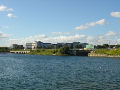
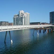
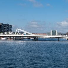
Sjællandsbroen, Road bridge in Copenhagen Municipality, Denmark.

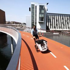
Sjællandsbroen is a road bridge in northeastern Copenhagen that connects two city districts across a waterway. The structure features multiple traffic lanes in each direction along with dedicated paths for pedestrians and cyclists.

The bridge opened in 1959 as a major infrastructure project serving Copenhagen's growth after World War II. Its completion made it easier to move between the expanding northern and eastern districts of the city.

The bridge connects two city districts and serves daily as a passage for commuters moving between neighborhoods. It has become a familiar landmark for residents whose routines cross from one side to the other.

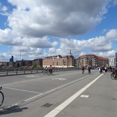
The bridge is open 24 hours for vehicle traffic and provides continuous paths for pedestrians and cyclists. When crossing during rush hours, expect busier conditions and plan extra time for your journey.

The bridge carries tens of thousands of vehicles daily, making it one of the region's busiest transportation routes. Despite this heavy use, it manages the constant flow with visibly stable infrastructure.

The community of curious travelers

AroundUs brings together thousands of curated places, local tips, and hidden gems, enriched daily by 60,000 contributors worldwide.

Start exploring
Inception
March 1, 1959
GPS coordinates
55.64159,12.55050
Latest update
December 12, 2025 09:03
Reviews
Share your experience

No review yet

Discussions
Start a discussion...

No discussion yet

« Sjællandsbroen - Road bridge in Copenhagen Municipality, Denmark » is provided by Around Us (aroundus.com). Images and texts are derived from Wikimedia project under a Creative Commons license. You are allowed to copy, distribute, and modify copies of this page, under the conditions set by the license, as long as this note is clearly visible.

Discover hidden gems everywhere you go!

From secret cafés to breathtaking viewpoints, skip the crowded tourist spots and find places that match your style. Our app makes it easy with voice search, smart filtering, route optimization, and insider tips from travelers worldwide. Download now for the complete mobile experience.

Around Us App Screenshot

A unique approach to discovering new places

Le Figaro

All the places worth exploring

France Info

A tailor-made excursion in just a few clicks

20 Minutes

Around Us
Travel Guide & Maps
Download

Send to your phone

QR Code
1

Open the camera app on your mobile.

2

Point at the QR code with your camera. A notification will appear.

3

Tap the notification to open the link.