Reggane, municipality of Algeria
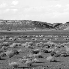
Reggane is a small town in Algeria's Sahara that serves as the district center in an arid landscape with minimal rainfall and extreme heat throughout the year. An oasis near the settlement provides water and vegetation in the midst of surrounding sandy plains, sand dune zones, and flat barren expanses that stretch toward distant horizons.
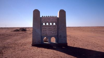
Reggane served for centuries as an important trading post on trans-Saharan routes where merchants exchanged goods such as salt and dates. In the early 1960s, before Algeria's independence, France conducted four nuclear weapons tests here that contaminated the environment and caused severe health consequences for the local population.
Reggane is home to Berber communities who have inhabited this Sahara region for generations, maintaining traditional livelihoods tied to oasis farming and herding. The town's identity today remains shaped by the nuclear testing era of the early 1960s, which altered the local consciousness and collective memory of its residents.
Reggane is accessible by air and road, serving as the last supply point on routes heading south across the desert. Heat is extreme, especially from May through September, so visitors should bring ample water and prepare for customs inspections required before crossing into desert regions.
Reggane was once known among ancient traders as a source of diamonds, earning it the nickname 'diamond country' from Arab and Berber merchants, a detail often overlooked today. Additionally, radioactivity from the tests traveled as far as Khartoum in Sudan thousands of kilometers away, demonstrating how far nuclear fallout can spread even from remote desert locations.
The community of curious travelers
AroundUs brings together thousands of curated places, local tips, and hidden gems, enriched daily by 60,000 contributors worldwide.