Enable Location

We need your location to show you interesting places around you

Discover nearby places

Find interesting locations and hidden gems around you

Precise directions

Get accurate directions and distances to places

Your location is never shared with other users. It's only used when you tap the location button.

Mount Tahat

Log in to your account

Start exploring — it's free

Trusted by 63,102 travelers worldwide

Continue with Google
Continue with Apple
or

We will send you a code to connect

By continuing, you accept our Terms and Conditions and our Privacy Policy

Check your inbox

We've sent a pincode in your inbox. Please enter the code below.

Mount Tahat
Discussion Reviews 1 Photos
18.7k Popularity

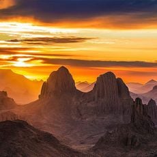
Mount Tahat, Volcanic mountain in Tamanrasset Province, Algeria

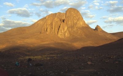
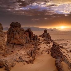
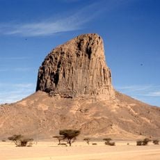
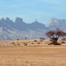
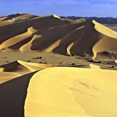
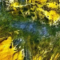
Mount Tahat rises to 2918 meters (9573 feet) as the highest summit in Algeria, located within the Hoggar Mountains of the Sahara. Black volcanic rock covers the upper sections, while the base is formed from pink granite.

The first documented ascent occurred in 1931 and marked an important moment in the exploration of Algerian mountain regions. Earlier crossings of the area by caravans left no written records of summit attempts.

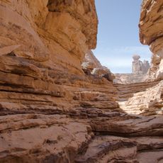
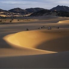
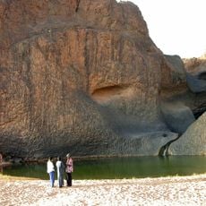
Local guides from nearby settlements know ancient routes that wind between rock formations and dry riverbeds. These paths were used for centuries by nomadic groups moving through the central Sahara.

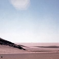
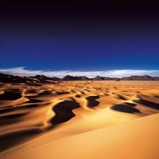
Expeditions typically start from the city of Tamanrasset, located 56 kilometers (35 miles) to the south, and require adequate supplies for demanding conditions. The best visiting period falls between November and March when temperatures are more moderate.

Clearly visible layers alternate basalt flows and volcanic necks, documenting millions of years of geological activity. The color contrasts between black volcanic rock and pink granite are especially striking when the sun is low.

The community of curious travelers

AroundUs brings together thousands of curated places, local tips, and hidden gems, enriched daily by 60,000 contributors worldwide.

Start exploring
Elevation above the sea
2,908 m
GPS coordinates
23.28879,5.53660
Latest update
December 5, 2025 22:29
Reviews
Share your experience

No review yet

Discussions
Start a discussion...

No discussion yet

« Mount Tahat - Volcanic mountain in Tamanrasset Province, Algeria » is provided by Around Us (aroundus.com). Images and texts are derived from Wikimedia project under a Creative Commons license. You are allowed to copy, distribute, and modify copies of this page, under the conditions set by the license, as long as this note is clearly visible.

Discover hidden gems everywhere you go!

From secret cafés to breathtaking viewpoints, skip the crowded tourist spots and find places that match your style. Our app makes it easy with voice search, smart filtering, route optimization, and insider tips from travelers worldwide. Download now for the complete mobile experience.

Around Us App Screenshot

A unique approach to discovering new places

Le Figaro

All the places worth exploring

France Info

A tailor-made excursion in just a few clicks

20 Minutes

Around Us
Travel Guide & Maps
Download

Send to your phone

QR Code
1

Open the camera app on your mobile.

2

Point at the QR code with your camera. A notification will appear.

3

Tap the notification to open the link.