Aïr and Ténéré National Nature Reserve
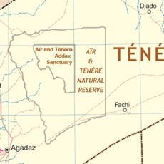
Aïr and Ténéré National Nature Reserve, Natural reserve and World Heritage Site in Agadez Region, Niger
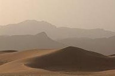
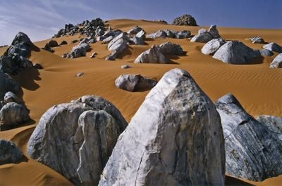
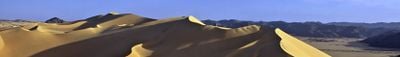
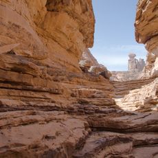
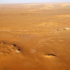
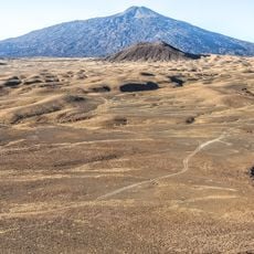
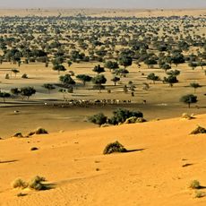
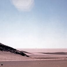
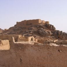
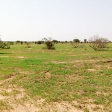
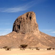
Aïr and Ténéré National Nature Reserve is a large protected area in the Agadez Region that combines rugged mountain peaks with sweeping sand formations. The landscape shifts between rocky uplands and smooth desert expanses, each shaped by different natural forces.
The reserve was established as a protected area in 1988 and gained World Heritage recognition 3 years later. This official status reflected growing concern for preserving the region's rare desert ecosystems.
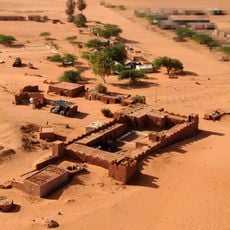
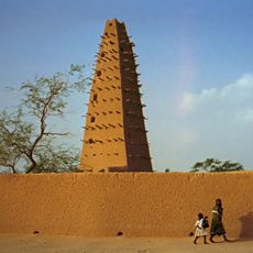
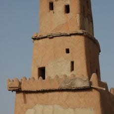
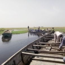
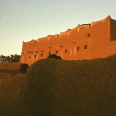
The Tuareg people live and work across this area, their daily practices shaped by generations of desert knowledge. Their presence gives the landscape a living, inhabited character rather than an empty wilderness.
You'll need permission from local authorities and experienced desert guides to enter the reserve, as travel here is challenging. Plan for extreme heat, limited water availability, and long distances between stopping points.
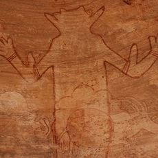
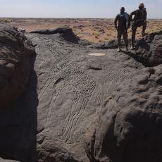
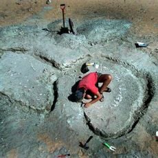
Ancient rock carvings scattered across the reserve show images of large animals that once roamed this desert. These engravings reveal how dramatically the landscape and its wildlife changed over thousands of years.
Location: Agadez Region
Inception: 1988
Website: http://cons-dev.org/consdev/niger/PARCAIR/ParcAir.html
GPS coordinates: 19.40000,9.70000
Latest update: December 6, 2025 17:40
Niger reveals its character through desert expanses, mud architecture, and traces of centuries of trade and culture. The Ténéré Desert stretches across the southeast, bordered by the Aïr Mountains where oases such as Timia provide relief from the surrounding sand. Agadez holds the 16th-century Great Mosque with its towering minaret and the Sultan's Palace, both shaped from adobe brick in the Sahelian style. In Niamey, the National Museum displays tools, textiles, and artifacts from Haussa, Zarma, and Tuareg communities, while the Grand Market fills covered passages with spices, fabrics, and everyday goods. Fort de Madama stands in ruin far to the northeast, a French military post from 1931 that once guarded caravan routes between Niger and Libya. Zinder preserves its own Great Mosque and Fort Tanimoune, and Dosso keeps the Palace of the Chief and Tunguma Stone as markers of local authority. Abaaba National Park shelters black rhinoceroses and Sahelian antelopes across thorn scrub and grassland, showing efforts to protect wildlife in a demanding climate. These places together tell the story of a country shaped by desert conditions, ancient trade, and the meeting of different peoples and beliefs.
Séfar
588.6 km
Tree of Ténéré
187.7 km
Mount Tahat
611.3 km
Tomb of Tin Hinan
633.8 km
Tadrart Acacus
608.4 km
Madama
499.9 km
Tassili Cultural Park
624.5 km
Gobero
258.6 km
Dabous Giraffes
270.5 km
Agadez Mosque
325.1 km
Tarso Toussidé
730.7 km
Ahaggar Cultural Park
593 km
Bichi Emirate
813.2 km
Kusugu
723.6 km
Gobarau Minaret
747.3 km
Termit Massif Reserve
393.7 km
Hadejia-Nguru wetlands
736.8 km
Muhammadu Dikko Stadium
748.2 km
Adrar Bous
129.1 km
Durbi Takusheyi
744.3 km
Fortress of Ghat
621.7 km
Gadoufaoua
287.3 km
Tiouraren Formation
380.4 km
Taourirt ta-n-Afella
708.2 km
Aïr and Ténéré Addax Sanctuary
22.7 km
Sultan's palace of Agadez
325 km
Gadabedji Reserve
543.5 km
Iharen
575.9 kmReviews
Visited this place? Tap the stars to rate it and share your experience / photos with the community! Try now! You can cancel it anytime.
Discover hidden gems everywhere you go!
From secret cafés to breathtaking viewpoints, skip the crowded tourist spots and find places that match your style. Our app makes it easy with voice search, smart filtering, route optimization, and insider tips from travelers worldwide. Download now for the complete mobile experience.
A unique approach to discovering new places❞
— Le Figaro
All the places worth exploring❞
— France Info
A tailor-made excursion in just a few clicks❞
— 20 Minutes