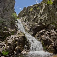
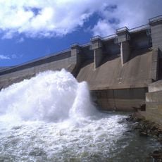
Chorrera de Mojonavalle, Mountain waterfall in Sierra de Guadarrama National Park, Spain.
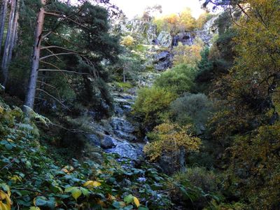
Chorrera de Mojonavalle is a waterfall in Sierra de Guadarrama National Park that cascades over uneven rocks as part of the Sestil del Maíllo stream. The water flows through mixed forest with pine and birch trees at around 1,600 meters elevation.
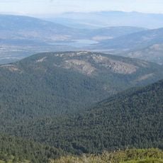
The waterfall is a natural feature in the Sierra de Guadarrama that has long been part of the Tajo River basin water system. The flow has shaped the landscape over many generations and continues to feed this important river system.
The waterfall draws hikers from Madrid and nearby areas who come here to spend time outdoors and observe wildlife. People visit throughout the year for walking and to watch birds in their natural habitat.
The waterfall is reached via a marked trail from Puerto de Canencia covering about 4 kilometers and requiring proper hiking gear. Visitors should pay attention to weather conditions, as the path can vary depending on the season.
The water drops roughly 30 meters, with the pool below changing depth significantly depending on the season. Heavy rain can turn the pool deep, while drier periods leave it shallow and small.
GPS coordinates: 40.86559,-3.78558
Latest update: December 14, 2025 18:41
Monasterio de El Paular
9 km
Cascadas del Purgatorio
6.5 km
Pinilla Reservoir
8.1 km
Monasterio de San Julián y San Antonio, La Cabrera
12.5 km
Puente del Perdón
8.8 km
Archaeological site of Los Calveros
6.8 km
Arboreto Giner de los Ríos
9 km
Asómate de Hoyos
10.6 km
Cabeza Mediana
10.5 km
Church of San Andrés Apóstol
9.2 km
Center for visitors of Puente del Perdón, Rascafría
9 km
Jardín educativo del Centro de Investigación Fernando González Bernáldez
12.4 km
Alamo
6 km
Church of San Salvador
9.6 km
Church of La Asunción de Nuestra Señora
6 km
Church of San Miguel
7.3 km
Church of Santa Marina
7.5 km
Torre de la Mina
4.6 km
Pinilla Dam
8.9 km
Town hall of Lozoya
9.6 km
Town hall of Rascafría
9.1 km
Plaza de toros de Miraflores de la Sierra
6.2 km
Miraflores de la Sierra reservoir
4.8 km
Iglesia de San Benito Abad, Gargantilla del Lozoya
12.4 km
Bridge of Congosto
9 km
Town Hall of Bustarviejo
6.4 km
Cabeza Mediana
10.5 km
Viaducto de Taboada
9.9 kmVisited this place? Tap the stars to rate it and share your experience / photos with the community! Try now! You can cancel it anytime.
Discover hidden gems everywhere you go!
From secret cafés to breathtaking viewpoints, skip the crowded tourist spots and find places that match your style. Our app makes it easy with voice search, smart filtering, route optimization, and insider tips from travelers worldwide. Download now for the complete mobile experience.
A unique approach to discovering new places❞
— Le Figaro
All the places worth exploring❞
— France Info
A tailor-made excursion in just a few clicks❞
— 20 Minutes