Enable Location

We need your location to show you interesting places around you

Discover nearby places

Find interesting locations and hidden gems around you

Precise directions

Get accurate directions and distances to places

Your location is never shared with other users. It's only used when you tap the location button.

Pointe des Arlicots

Log in to your account

Start exploring — it's free

Trusted by 61,915 travelers worldwide

Continue with Google
Continue with Apple
or

We will send you a code to connect

By continuing, you accept our Terms and Conditions and our Privacy Policy

Check your inbox

We've sent a pincode in your inbox. Please enter the code below.

Pointe des Arlicots

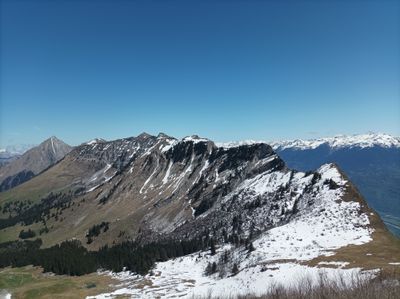
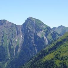
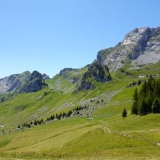
Pointe des Arlicots, Mountain summit in Bauges range, France

Pointe des Arlicots is a summit in the Bauges range that rises to 2060 meters with exposed limestone cliffs. The bare rock faces are visible from the Isère Valley and shape the landscape of the region.

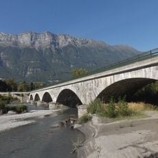
Local farmers once used mountain paths to reach high meadows for seasonal work in the early 1900s. These routes were part of daily life for those who depended on mountain resources.

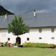
The area shows traditional Alpine herding with old shepherd shelters scattered at different elevations. These huts recall when herds moved seasonally to high meadows for grazing.

The ascent requires technical climbing skills and careful navigation, especially along the ridge between Pointe des Arces and the summit. Hikers should be comfortable with difficult terrain and check weather before starting.

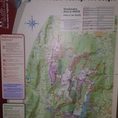
The Vallon de la Lanche route now provides access through a former exclusion zone. This newer trail offers visitors an alternative path that fewer people know about.

The community of curious travelers

AroundUs brings together thousands of curated places, local tips, and hidden gems, enriched daily by 60,000 contributors worldwide.

Start exploring
Location
Location
Elevation above the sea
2,060 m
GPS coordinates
45.60746,6.20680
Latest update
December 15, 2025 13:25
« Pointe des Arlicots - Mountain summit in Bauges range, France » is provided by Around Us (aroundus.com). Images and texts are derived from Wikimedia project under a Creative Commons license. You are allowed to copy, distribute, and modify copies of this page, under the conditions set by the license, as long as this note is clearly visible.

Discover hidden gems everywhere you go!

From secret cafés to breathtaking viewpoints, skip the crowded tourist spots and find places that match your style. Our app makes it easy with voice search, smart filtering, route optimization, and insider tips from travelers worldwide. Download now for the complete mobile experience.

Around Us App Screenshot

A unique approach to discovering new places

Le Figaro

All the places worth exploring

France Info

A tailor-made excursion in just a few clicks

20 Minutes

Around Us
Travel Guide & Maps
Download

Send to your phone

QR Code
1

Open the camera app on your mobile.

2

Point at the QR code with your camera. A notification will appear.

3

Tap the notification to open the link.