Pettorano sul Gizio

Log in to your account

AroundUs is a community-driven map of interesting places, built by curious explorers like you. It grows with every review, story, and photo you share.
Connect to save your favorite spots, contribute locations, and create personalized routes.
Continue with Google
Continue with Apple
Continue with X
Continue with Facebook
Continue with email
By continuing, you accept our Terms and Conditions and our Privacy Policy
Create an account
Add to collection
Map
Suggest a change
Share

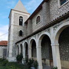
Pettorano sul Gizio, Medieval commune in Province of L'Aquila, Italy

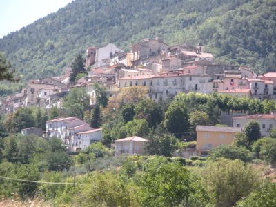
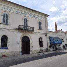
Pettorano sul Gizio is a commune in the Province of L'Aquila situated at approximately 625 meters elevation between the Gizio and Riaccio rivers in the Peligna Valley. The settlement extends across roughly 62 square kilometers of land positioned between these river systems in a valley landscape.

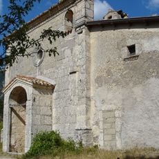
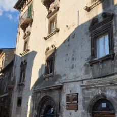
Archaeological remains from Mount Genzana reveal human settlements dating to paleolithic times, while an Iron Age fortification was discovered at Monte Mitra. These findings show that the area has been inhabited since prehistoric eras through successive periods.

The Santa Margherita celebration on July 13 brings the community together with traditional music, local food dishes, and religious ceremonies. This gathering reflects how residents mark important moments through shared practices and local customs.

The main access route is via the Bussi-Popoli highway exit or by train to Sulmona station followed by local bus service. Visitors should plan ahead since the terrain is mountainous and bus schedules operate on set routes and times.

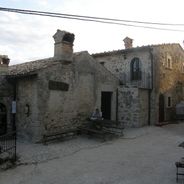
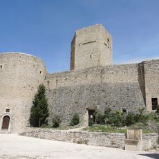
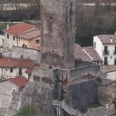
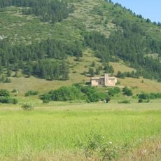
Cantelmo Castle stands out for its unusual pentagonal tower positioned beside two circular towers, creating a rare medieval fortification design. This five-sided tower shape differs markedly from common castle structures, making the fortification architecturally distinctive.

Location: Province of L'Aquila

Capital city: Pettorano sul Gizio

Elevation above the sea: 625 m

Shares border with: Introdacqua, Rocca Pia, Scanno, Abruzzo, Cansano, Pescocostanzo, Sulmona

Website: http://comune.pettorano.aq.it

GPS coordinates: 41.97556,13.95972

Latest update: December 6, 2025 16:03

Photos
Cultural sites and natural areas in Abruzzo

Abruzzo brings together medieval villages, Roman sites, and mountain landscapes. Rocca Calascio rises to 1,460 meters (4,790 feet), offering views across the region from its ancient fortress walls. Gran Sasso and Majella national parks welcome hikers to explore trails through mountain terrain, where...

Reviews

Visited this place? Tap the stars to rate it and share your experience / photos with the community! Try now! You can cancel it anytime.

« Pettorano sul Gizio - Medieval commune in Province of L'Aquila, Italy » is provided by Around Us (aroundus.com). Images and texts are derived from Wikimedia project under a Creative Commons license. You are allowed to copy, distribute, and modify copies of this page, under the conditions set by the license, as long as this note is clearly visible.

Discover hidden gems everywhere you go!

From secret cafés to breathtaking viewpoints, skip the crowded tourist spots and find places that match your style. Our app makes it easy with voice search, smart filtering, route optimization, and insider tips from travelers worldwide. Download now for the complete mobile experience.

Around Us App Screenshot

A unique approach to discovering new places

Le Figaro

All the places worth exploring

France Info

A tailor-made excursion in just a few clicks

20 Minutes