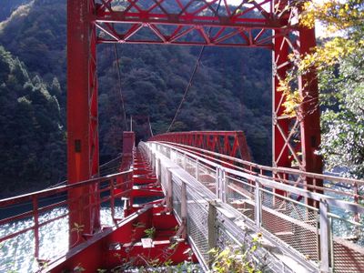
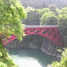
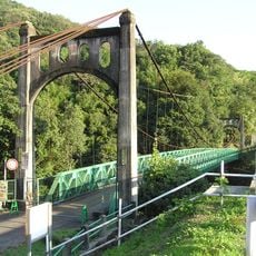
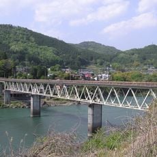
五月橋, Suspension bridge over Kiso River in Yaotsu, Japan.
The Satsuki Bridge is a suspension bridge crossing the Kiso River between Yaotsu and Mizunami, featuring a metal mesh walkway surface. Its steel cable structure and supports span across the river, connecting both communities on either side.
The bridge was built in 1954 as part of Gifu Prefectural Road 352, serving vehicle traffic between the two banks. Heavy rainfall in 1982 caused significant damage, leading to changes in its use and future maintenance plans.
The bridge connects two communities and creates a physical meeting point for people on both sides. It remains part of local daily life and travel routes in the region.
The bridge is currently open for pedestrian access only with a secure metal mesh walkway surface. Check local conditions before visiting, as future construction projects may affect access to the structure.
The bridge was constructed using advanced steel cable engineering techniques that were innovative for the 1950s. This construction method represented modern infrastructure development practices in postwar Japan.
The community of curious travelers
AroundUs brings together thousands of curated places, local tips, and hidden gems, enriched daily by 60,000 contributors worldwide.