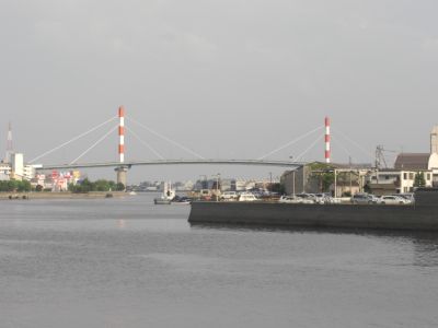
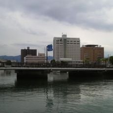
Suehiro Bridge, Cable-stayed bridge in Tokushima, Japan
Suehiro Bridge is a cable-stayed bridge in Tokushima that spans across the Shinmachi River. It connects the eastern parts of the city and features two prominent towers that rise above the surrounding neighborhoods.
This structure opened in 1975 and represented an important milestone in bridge engineering for Japan at that time. Its construction helped improve connections between different parts of the city during a period of rapid urban growth.
The bridge's two supporting towers display red and white stripes, following Japanese aviation safety standards for tall structures.
This bridge primarily serves motor vehicle traffic and forms part of key road routes through the city. You can cross it to reach the eastern areas or simply observe the flow of city traffic from its vantage point.
Until April 1997, the bridge operated as a toll road, charging 200 yen for standard vehicles and 20 yen for motorcycles.
The community of curious travelers
AroundUs brings together thousands of curated places, local tips, and hidden gems, enriched daily by 60,000 contributors worldwide.