Enable Location

We need your location to show you interesting places around you

Discover nearby places

Find interesting locations and hidden gems around you

Precise directions

Get accurate directions and distances to places

Your location is never shared with other users. It's only used when you tap the location button.

Garwolin County

Log in to your account

Start exploring — it's free

Trusted by 62,169 travelers worldwide

Continue with Google
Continue with Apple
or

We will send you a code to connect

By continuing, you accept our Terms and Conditions and our Privacy Policy

Check your inbox

We've sent a pincode in your inbox. Please enter the code below.

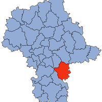
Garwolin County, Administrative district in Masovian Voivodeship, Poland

Garwolin County is an administrative district in the Masovian Voivodeship in east-central Poland. The area contains four towns and numerous rural settlements spread across fourteen administrative subdivisions.

The district was established in 1999 as an independent administrative unit following a nationwide restructuring of local government. This reorganization created the current structure of towns and municipalities in the area.

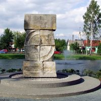
The fourteen municipalities in the county celebrate regional food, music, and crafts through regular festivals that bring communities together. These events reveal how local traditions remain part of daily life across the area.

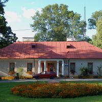
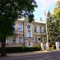
The district is accessible by road and has a main administrative office in Garwolin city. The four town halls in Garwolin, Łaskarzew, Pilawa, and Żelechów provide local services to residents across the region.

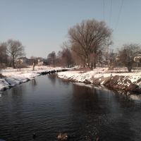
The county is shaped by the Wilga River, which flows through the landscape and creates distinct ecological zones across the territory. This waterway runs between the four urban centers and supports the area's agricultural character.

The community of curious travelers

AroundUs brings together thousands of curated places, local tips, and hidden gems, enriched daily by 60,000 contributors worldwide.

Start exploring
Capital city
Garwolin
Shares border with
Kozienice County, Grójec County, Otwock County, Mińsk County, Łuków County, Ryki County, Siedlce County
GPS coordinates
51.90000,21.63333
Latest update
December 7, 2025 20:48
« Garwolin County - Administrative district in Masovian Voivodeship, Poland » is provided by Around Us (aroundus.com). Images and texts are derived from Wikimedia project under a Creative Commons license. You are allowed to copy, distribute, and modify copies of this page, under the conditions set by the license, as long as this note is clearly visible.

Discover hidden gems everywhere you go!

From secret cafés to breathtaking viewpoints, skip the crowded tourist spots and find places that match your style. Our app makes it easy with voice search, smart filtering, route optimization, and insider tips from travelers worldwide. Download now for the complete mobile experience.

Around Us App Screenshot

A unique approach to discovering new places

Le Figaro

All the places worth exploring

France Info

A tailor-made excursion in just a few clicks

20 Minutes

Around Us
Travel Guide & Maps
Download

Send to your phone

QR Code
1

Open the camera app on your mobile.

2

Point at the QR code with your camera. A notification will appear.

3

Tap the notification to open the link.