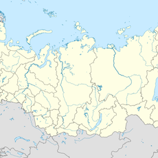
Aktashsky Proval Lake, Protected lake in Tatarstan, Russia.
Aktashsky Proval Lake is a round karst lake, 28 m across, lying at the bottom of a 20 m deep collapse funnel near the village of Kaleykino in Tatarstan's Almetyevsky District. Its water surface covers 0.03 hectares, and the lake reaches a maximum depth of 25 m. The basin has no outlet; it is fed by groundwater.
The depression opened on 7 August 1939, when the ground collapsed under a tractor ploughing a field near Kaleykino; the driver went down with it. The first hole measured 3×2 m and was reported as 50 to 80 m deep. By 1951 G. N. Petrov recorded a funnel about 50 m across and 25 m deep with a lake roughly 10 m wide at the bottom. It became a regional nature monument in 1978 and again under a 2005 decree.
The lake is known locally as Aktash Upkyny in Tatar; Aktash means "white stone". The site is a regional nature monument under the Tatarstan Council of Ministers decree of 10 January 1978 (No. 25) and a Cabinet of Ministers decree of 29 December 2005 (No. 644). Tatar-language accounts, such as Adler Timergalin's in "Beznen Miras" (June 2014), retell the 1939 collapse as the moment the earth "swallowed" a tractor.
The lake lies on the floor of a 20 m deep funnel near Kaleykino in Almetyevsk District, about 28 m across, with the water surface at 0.03 ha. Access is from the village; the descent into the funnel is steep, so sturdy footwear helps. The water is mineral-rich and fed by groundwater, not suitable for drinking.
The lake sits at the bottom of a funnel 20 m deep, itself the result of a collapse on 7 August 1939, when the ground gave way under a tractor driver working a field; the first hole measured 3×2 m. Its volume is about 3,000 m³, fed steadily by underground water of the hydrocarbonate-calcium type.
The community of curious travelers
AroundUs brings together thousands of curated places, local tips, and hidden gems, enriched daily by 94,161 contributors worldwide.