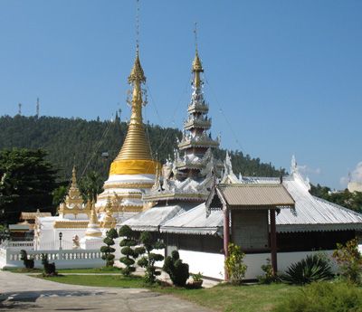
Mueang Mae Hong Son, district in Mae Hong Son province, Thailand
Location: Mae Hong Son
Elevation above the sea: 430 m
Address: Mueang Mae Hong Son District, Mae Hong Son 58000, Thailand 58000 58000
GPS coordinates: 19.26667,97.93333
Latest update: March 27, 2025 08:29
Doi Inthanon
95.4 km
Elephant Nature Park
97.5 km
Wat Phra That Doi Kong Mu
4.7 km
Tham Lot
49.6 km
Wat Phra Puttha Baht Si Roi
91.5 km
Huai Nam Dang National Park
70.3 km
Thai National Observatory
95.2 km
တောင်ကွဲစေတီတော်
88.2 km
Wat Chong Kham
5 km
Namtok Mae Surin National Park
17.5 km
Thung Bua Tong Forest Park
44.5 km
Tham Pla - Namtok Pha Suea National Park
27.3 km
Tham Lod Cave
49.2 km
Wat To Phae
52 km
Kayah State Cultural Museum
89.6 km
Wat Pa Daet
99.3 km
Pha Bong Viewpoint
12.1 km
Mae Surin Falls
39.2 km
Wat Phut En
94.7 km
Wat Hua Wiang
5.2 km
Wat Kam Ko
4.7 km
Wat Luang
54.1 km
Wat Ban Chiang
95.3 km
Cave of the Monk
94.7 km
Wat Klang
54.5 km
Wat Pa Kham
54.6 km
Wat Chong Klang
5 km
Mae Hong Son
7 kmReviews
Visited this place? Tap the stars to rate it and share your experience / photos with the community! Try now! You can cancel it anytime.
Discover hidden gems everywhere you go!
From secret cafés to breathtaking viewpoints, skip the crowded tourist spots and find places that match your style. Our app makes it easy with voice search, smart filtering, route optimization, and insider tips from travelers worldwide. Download now for the complete mobile experience.
A unique approach to discovering new places❞
— Le Figaro
All the places worth exploring❞
— France Info
A tailor-made excursion in just a few clicks❞
— 20 Minutes