Fountains Abbey, Abbey ruins in the United Kingdom
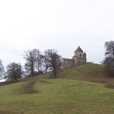
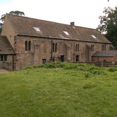
Fountains Abbey is a large ruined Cistercian monastery with substantial stone structures still standing today. The site shows the layout of a church, cloisters, and residential buildings that reveal how the monastic community was organized.
The monastery was founded in 1132 and became a major center of Cistercian life in England for centuries. It was abandoned and destroyed during the dissolution of monasteries under King Henry VIII in 1539.
The place represents the way Cistercian monks lived together and organized their daily routines through shared work. Visitors can walk among the remaining walls and imagine the rhythm of monastic communities that once thrived here.
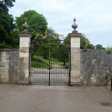
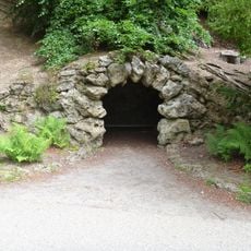
The site is accessible on foot, and visitors can explore at their own pace across different areas of the grounds. Sturdy footwear is recommended since the terrain is uneven with paths winding through the ruins.
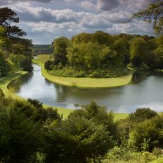
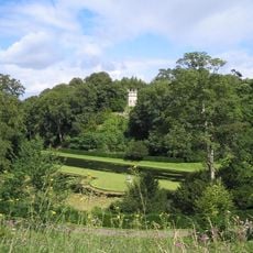
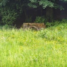
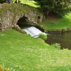
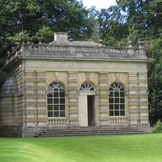
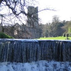
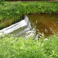
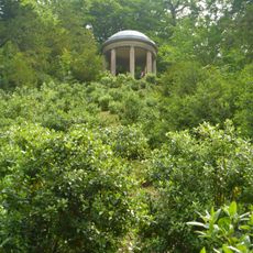
The ruins were incorporated into an 18th-century water garden designed in the Georgian style, creating an unusual blend with the medieval remains. This arrangement shows how later landowners repurposed the historical site as a focal point for fashionable landscaping.
Location: Lindrick with Studley Royal and Fountains
Inception: 12 century
Made from material: stone
Part of: Studley Royal Park including the Ruins of Fountains Abbey
Address: Fountains, Ripon HG4 3DY, UK
Opening Hours: Monday-Sunday 10:00-16:00
Phone: +441765608888
Website: https://nationaltrust.org.uk/fountains-abbey-and-studley-royal-water-garden
GPS coordinates: 54.10970,-1.58139
Latest update: January 9, 2026 09:47
Studley Royal Park
832 m
Fountains Hall
329 m
St Mary's Church, Studley Royal
1 km
Church of Saint Lawrence
1.5 km
Statue on West Side of North Crescent Pond
807 m
Studley Royal Park including the Ruins of Fountains Abbey
897 m
Statue of Neptune and Pedestal in Centre of Moon Pond
764 m
The Octagon Tower
916 m
Weir and reservoir below Tent Hill
720 m
Temple Of Piety On East Side Of Moon Pond
801 m
The Wrestlers
831 m
Robin Hood's Well
213 m
Rustic Bridge At South End Of The Canal, With Culvert And Arch To Reservoir
628 m
Banqueting House Approximately 100 Metres To West Of The Canal
705 m
Tunnel Approximately 20 Metres West Of The Octagon, With Flanking Wall Attached To South
917 m
How Hill Tower
1.2 km
Weir At North End Of The Canal, With Piers, Fishing Pavilions And Balustrade
961 m
The Obelisk Approximately 80 Metres West Of Church Of St Mary
971 m
Quebec Monument
665 m
Abbey Mill
227 m
Weir On River Skell Approximately 120 Metres West Of The Reservoir
407 m
Weir On River Skell Approximately 10 Metres East Of The Infirmary At Fountains Abbey
164 m
Site of medieval chapel and section of Fountains Park park pale, 170m south west of How Hill Farm
1.2 km
Boundary Wall With West And South Gates, Church Of St Mary
991 m
Temple Of Fame On Cliff Top At South Side Of Moon Pond
752 m
The Canal Gates And Flanking Walls On West Side Of The Lake
908 m
Stewards House, Now National Trust Restaurant And Shop
905 m
Grotto On North Side Of Reservoir
705 mVisited this place? Tap the stars to rate it and share your experience / photos with the community! Try now! You can cancel it anytime.
Discover hidden gems everywhere you go!
From secret cafés to breathtaking viewpoints, skip the crowded tourist spots and find places that match your style. Our app makes it easy with voice search, smart filtering, route optimization, and insider tips from travelers worldwide. Download now for the complete mobile experience.
A unique approach to discovering new places❞
— Le Figaro
All the places worth exploring❞
— France Info
A tailor-made excursion in just a few clicks❞
— 20 Minutes