Second Severn Crossing, Cable-stayed bridge in South West England, United Kingdom.
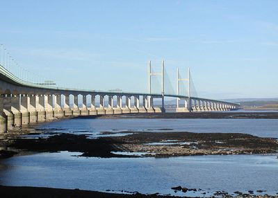
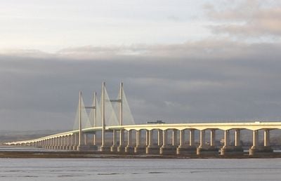
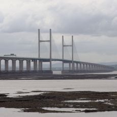
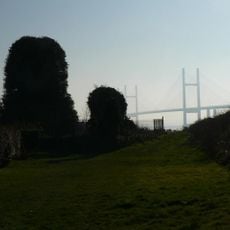
The Second Severn Crossing is a cable-stayed bridge spanning the Severn Estuary between southern England and Wales, extending 5,128 meters (16,822 feet). The main concrete and steel towers rise 137 meters (450 feet) above the water, carrying a 34.6-meter-wide roadway.
The crossing opened in 1996 to handle growing traffic on the route between both countries. It was built as a second route alongside the older first Severn crossing, which had been constructed decades earlier.
The bridge carries a new name since 2018, referencing a historic title in the British monarchy. Travelers crossing between both countries pass over the wide estuary that formed a natural boundary for centuries.
The six traffic lanes run at a height that can be exposed to strong winds, especially in stormy weather. There are no footpaths or cycle paths on the roadway, as access is exclusively for motor vehicles.
The towers stand on islands in the estuary that were created artificially during construction. The design uses segmental construction, with sections prefabricated on land and then floated to the assembly site on pontoons.
Location: South Gloucestershire
Location: Monmouthshire
Inception: 1996
Official opening: June 5, 1996
Height: 137 m
Length: 5,128 m
Longest Span: 456 m
Width: 34.6 m
Made from material: concrete, steel
GPS coordinates: 51.57450,-2.70160
Latest update: December 13, 2025 17:47
Caldicot Castle
3.5 km
Mathern Palace
4.5 km
Dewstow House
5.3 km
Church Of St Mary
3.9 km
Church Of St Tewdric
4.5 km
English Stones
1.4 km
Gatehouse and attached range at St Pierre Hotel
4.2 km
Moynes Court
4.6 km
Church Farmhouse
4 km
Runston Chapel
5.5 km
Church of St Mary, Portskewett
2.3 km
Manor Farmhouse
4.6 km
Mathern Mill And Attached House
5.2 km
Chapel Rock Lighthouse
4.9 km
Church of St Peter
4.5 km
Church of St Peter
4.1 km
Holy Trinity Church
1.2 km
Portskewett House
2.3 km
Severn Lodge Farmhouse
2.8 km
St Twrog's Chapel
4.9 km
Severn Tunnel East Portal (bsw1101)
3.2 km
Northwick House Farmhouse With Attached Barn And Dairy Range
4.6 km
Sandfords Charity School
4.5 km
Overthrow, Lantern And Gate About 17 Metres West Of Church Of St Peter
4.5 km
Grotto About 30m To The South East Of Dewstow House
5.3 km
Sudbrook Pump House
1.3 km
Mathern War Memorial
5.3 km
Portskewett War Memorial
2.3 kmVisited this place? Tap the stars to rate it and share your experience / photos with the community! Try now! You can cancel it anytime.
Discover hidden gems everywhere you go!
From secret cafés to breathtaking viewpoints, skip the crowded tourist spots and find places that match your style. Our app makes it easy with voice search, smart filtering, route optimization, and insider tips from travelers worldwide. Download now for the complete mobile experience.
A unique approach to discovering new places❞
— Le Figaro
All the places worth exploring❞
— France Info
A tailor-made excursion in just a few clicks❞
— 20 Minutes