Nico Ditch, Linear earthwork in Greater Manchester, England
The Nico Ditch is a linear earthwork extending roughly six miles between Ashton-under-Lyne and Stretford, measuring about four meters wide and one and a half meters deep. This structure represents a large-scale defensive or boundary line from centuries ago.
The earthwork was constructed between the fifth and eleventh centuries, with its first written mention appearing in a document from the twelfth century. This timeline suggests the structure developed gradually over several medieval centuries.
Local people built different sections of the ditch, with each person responsible for digging a length matching their own height. This method reveals how communities organized shared labor in medieval times.
A preserved section of around three hundred meters can be seen at Denton Golf Course, where the original construction is clearly visible. Visitors can walk the grounds there and observe the earthwork's shape from close up.
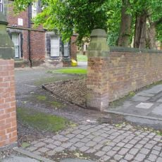
The earthwork crosses four metropolitan boroughs and lies partly hidden beneath Audenshaw reservoirs, which were built in the nineteenth century. This overlap demonstrates how later developments can cover older structures from view.
Location: Manchester
Location: Tameside
Location: Trafford
GPS coordinates: 53.45080,-2.17688
Latest update: December 7, 2025 10:04
Gorton Monastery
2.1 km
Houldsworth Mill, Reddish
1.8 km
Debdale Park
1.5 km
St. Elisabeth's Church
1.7 km
Broadstone Mill, Reddish
2 km
Brookfield Unitarian Church
1.2 km
Highfield Country Park
1.1 km
Peacock Mausoleum
1.1 km
Gorton Reservoirs
1.7 km
Houldsworth Working Men's Club
1.9 km
The Plough, Gorton
1.2 km
Church of St Peter
1.1 km
Church of St Agnes
1.4 km
Church of St Mark
605 m
Church of St James
1.6 km
Church of St John
1.9 km
Church of St Andrew
1.7 km
Beswick Co-operative Society Building
1.2 km
Gorton and Abbey Hey War Memorial
2.1 km
Wall to the west and south of Church of St Elizabeth
1.7 km
Rectory to Church of St Elisabeth
1.6 km
Houldsworth School
1.6 km
Clock and Drinking Fountain
1.8 km
Shores Fold Farmhouse
1.9 km
Wall to west of Houldsworth School
1.6 km
Wall to west of Church of St Elisabeth
1.6 km
Milestone, Stockport Road, Levenshulme; opp. jcn Cringle Rd by No. 1156
1.6 km
Milestone, Stockport Road; Longsight
2 kmVisited this place? Tap the stars to rate it and share your experience / photos with the community! Try now! You can cancel it anytime.
Discover hidden gems everywhere you go!
From secret cafés to breathtaking viewpoints, skip the crowded tourist spots and find places that match your style. Our app makes it easy with voice search, smart filtering, route optimization, and insider tips from travelers worldwide. Download now for the complete mobile experience.
A unique approach to discovering new places❞
— Le Figaro
All the places worth exploring❞
— France Info
A tailor-made excursion in just a few clicks❞
— 20 Minutes