Enable Location

We need your location to show you interesting places around you

Discover nearby places

Find interesting locations and hidden gems around you

Precise directions

Get accurate directions and distances to places

Your location is never shared with other users. It's only used when you tap the location button.

Dun Vulan

Log in to your account

Start exploring — it's free

Trusted by 61,668 travelers worldwide

Continue with Google
Continue with Apple
or

We will send you a code to connect

By continuing, you accept our Terms and Conditions and our Privacy Policy

Check your inbox

We've sent a pincode in your inbox. Please enter the code below.

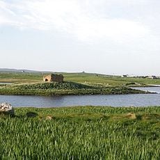
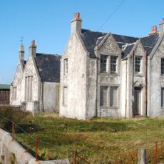
Dun Vulan, Iron Age broch in South Uist, Scotland

Description

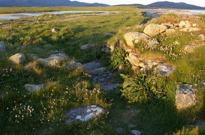
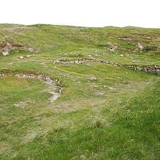
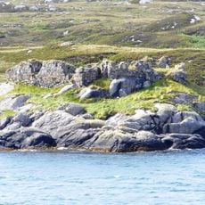
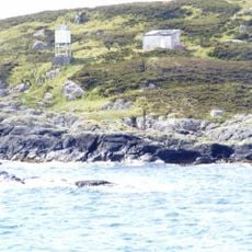
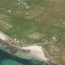
Dun Vulan is an Iron Age broch situated on a coastal promontory, shaped by the elements over centuries. The ruins still display the characteristic circular form with thick walls designed for defense and shelter.

History

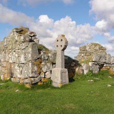
The structure was built between 150 and 50 BC as a fortified residence occupied for several centuries. Archaeological findings show that it formed part of a long-term settlement pattern in the region.

Culture

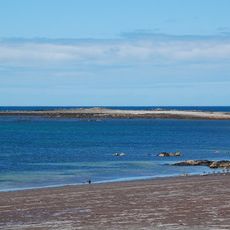
The name refers to a dark place in Gaelic, reflecting the rugged character of the island itself. Visitors can observe how the structure sits embedded in the rocky coastal landscape, showing the relationship between the people who lived here and their harsh surroundings.

Practical

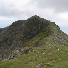
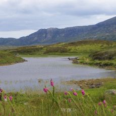
The site sits on a rugged coastline and requires sturdy footwear and preparation for changing weather conditions. Access is via local paths from nearby villages, and visitors should allow time for careful movement across uneven terrain.

Did you know?

Two paved outbuildings discovered nearby are considered the earliest rectangular structures in the Western Isles. Their remains show a transition to different building types that unfolded gradually over generations.

Location
Location
GPS coordinates
57.24062,-7.44918
Latest update
December 14, 2025 16:46

AroundUs brings together thousands of curated places, local tips, and hidden gems, enriched daily by 60,000 contributors worldwide. Discover all places nearby (Outer Hebrides).

Around this place
Cladh Hallan
United Kingdom

Cladh Hallan

8.1 km
Our Lady of the Isles
United Kingdom

Our Lady of the Isles

12.6 km
Beinn Mhòr
United Kingdom

Beinn Mhòr

9.5 km
Ormacleit Castle
United Kingdom

Ormacleit Castle

3.3 km
Calvay Castle
United Kingdom

Calvay Castle

15.6 km
Loch Druidibeg
United Kingdom

Loch Druidibeg

12.5 km
South Uist Machair and Lochs
United Kingdom

South Uist Machair and Lochs

10.4 km
An Carra, standing stone
United Kingdom

An Carra, standing stone

6.1 km
St Peter's R.C. Church, Daliburgh, South Uist
United Kingdom

St Peter's R.C. Church, Daliburgh, South Uist

9.3 km
Garrynamonie, Our Lady Of Sorrows Rc Church Including Boundary Walls And Gatepiers
United Kingdom

Garrynamonie, Our Lady Of Sorrows Rc Church Including Boundary Walls And Gatepiers

14 km
Calvay light
United Kingdom

Calvay light

16 km
Teampull Moire,churches,chapels and enclosures,Howmore
United Kingdom

Teampull Moire,churches,chapels and enclosures,Howmore

8 km
South Uist, Ardkenneth, St Michael's Church, Presbytery
United Kingdom

South Uist, Ardkenneth, St Michael's Church, Presbytery

16.7 km
South Uist, Howmore, Parish Church
United Kingdom

South Uist, Howmore, Parish Church

7.8 km
Kildonan Museum, shielings 460m ENE of
United Kingdom

Kildonan Museum, shielings 460m ENE of

4.2 km
Ormallett House, Ormiclate, South Uist
United Kingdom

Ormallett House, Ormiclate, South Uist

3.3 km
South Uist, Daliburgh Parish Church
United Kingdom

South Uist, Daliburgh Parish Church

9.3 km
South Uist, Pollachar Inn
United Kingdom

South Uist, Pollachar Inn

15.7 km
South Uist, Ardkenneth, St Michael's Church
United Kingdom

South Uist, Ardkenneth, St Michael's Church

16.7 km
Caisteal Bheagram,castle,Drimsdale
United Kingdom

Caisteal Bheagram,castle,Drimsdale

8.7 km
West Kilbride Walled Garden, South Uist
United Kingdom

West Kilbride Walled Garden, South Uist

16.3 km
South Uist, Askernish House
United Kingdom

South Uist, Askernish House

6.3 km
Pollachar,standing stone 250m SW of
United Kingdom

Pollachar,standing stone 250m SW of

15.7 km
Bruthach an Tionail Ard,wheelhouse settlement,Kilpheder
United Kingdom

Bruthach an Tionail Ard,wheelhouse settlement,Kilpheder

9.8 km
Crois Chnoca Breaca,standing stone
United Kingdom

Crois Chnoca Breaca,standing stone

4.3 km
Schoolhouse, Lochboisdale, South Uist
United Kingdom

Schoolhouse, Lochboisdale, South Uist

12 km
School, Lochboisdale, South Uist
United Kingdom

School, Lochboisdale, South Uist

12 km
Vorran Island
United Kingdom

Vorran Island

5.2 km
Show the full map
« Dun Vulan - Iron Age broch in South Uist, Scotland » is provided by Around Us (aroundus.com). Images and texts are derived from Wikimedia project under a Creative Commons license. You are allowed to copy, distribute, and modify copies of this page, under the conditions set by the license, as long as this note is clearly visible.

Discover hidden gems everywhere you go!

From secret cafés to breathtaking viewpoints, skip the crowded tourist spots and find places that match your style. Our app makes it easy with voice search, smart filtering, route optimization, and insider tips from travelers worldwide. Download now for the complete mobile experience.

Around Us App Screenshot

A unique approach to discovering new places

Le Figaro

All the places worth exploring

France Info

A tailor-made excursion in just a few clicks

20 Minutes

Around Us
Travel Guide & Maps
Download

Send to your phone

QR Code
1

Open the camera app on your mobile.

2

Point at the QR code with your camera. A notification will appear.

3

Tap the notification to open the link.