Enable Location

We need your location to show you interesting places around you

Discover nearby places

Find interesting locations and hidden gems around you

Precise directions

Get accurate directions and distances to places

Your location is never shared with other users. It's only used when you tap the location button.

Beinn Mhòr

Log in to your account

Start exploring — it's free

Trusted by 62,384 travelers worldwide

Continue with Google
Continue with Apple
or

We will send you a code to connect

By continuing, you accept our Terms and Conditions and our Privacy Policy

Check your inbox

We've sent a pincode in your inbox. Please enter the code below.

Beinn Mhòr

Beinn Mhòr, Mountain summit in South Uist, Outer Hebrides, Scotland.

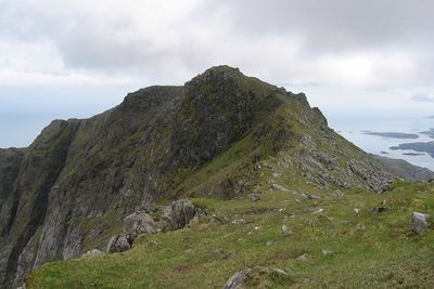
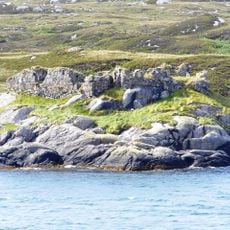
Beinn Mhòr is the highest summit in the Uist island chain in the Outer Hebrides, rising to 620 meters above sea level. The north-facing slopes feature distinctive rock buttresses and gullies that define the mountain's character.

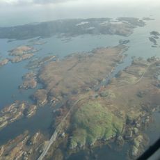
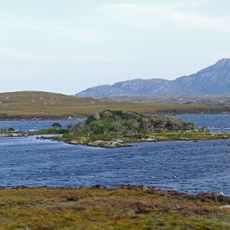
The mountain has served generations of island inhabitants as a landmark and navigation point across the rugged Hebridean landscape. Its prominence made it a reliable reference for communities navigating this remote region.

The name comes from Scottish Gaelic, meaning "Big Mountain", reflecting the strong linguistic heritage of the Hebrides. Visitors can still hear Gaelic spoken in the region today and see it on local signs and maps.

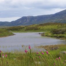
The climb is best accessed from Loch Dobhrain near Snishival, with about two hours of walking needed to reach the base of the rock buttresses. Visitors should come prepared for rapidly changing weather conditions common in this exposed mountain region.

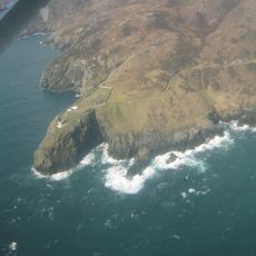
The north side features seven distinct rock buttresses separated by six gullies, creating a rare geological formation. This Heileasdale section attracts experienced climbers but remains overlooked by most casual hikers visiting the area.

The community of curious travelers

AroundUs brings together thousands of curated places, local tips, and hidden gems, enriched daily by 60,000 contributors worldwide.

Start exploring
Location
Elevation above the sea
620 m
GPS coordinates
57.25874,-7.29484
Latest update
December 12, 2025 16:40
Around this place
Cladh Hallan
United Kingdom

Cladh Hallan

11.9 km
Our Lady of the Isles
United Kingdom

Our Lady of the Isles

10.2 km
Ormacleit Castle
United Kingdom

Ormacleit Castle

6.9 km
Calvay Castle
United Kingdom

Calvay Castle

13 km
Ushenish Lighthouse
United Kingdom

Ushenish Lighthouse

7.5 km
Dun Vulan
United Kingdom

Dun Vulan

9.5 km
Loch Druidibeg
United Kingdom

Loch Druidibeg

8.6 km
Eilean na Cille
United Kingdom

Eilean na Cille

14.8 km
South Uist Machair and Lochs
United Kingdom

South Uist Machair and Lochs

7.2 km
An Carra, standing stone
United Kingdom

An Carra, standing stone

3.9 km
St Peter's R.C. Church, Daliburgh, South Uist
United Kingdom

St Peter's R.C. Church, Daliburgh, South Uist

11.8 km
Garrynamonie, Our Lady Of Sorrows Rc Church Including Boundary Walls And Gatepiers
United Kingdom

Garrynamonie, Our Lady Of Sorrows Rc Church Including Boundary Walls And Gatepiers

15.4 km
Calvay light
United Kingdom

Calvay light

13.2 km
Teampull Moire,churches,chapels and enclosures,Howmore
United Kingdom

Teampull Moire,churches,chapels and enclosures,Howmore

7.4 km
South Uist, Ardkenneth, St Michael's Church, Presbytery
United Kingdom

South Uist, Ardkenneth, St Michael's Church, Presbytery

15.6 km
South Uist, Howmore, Parish Church
United Kingdom

South Uist, Howmore, Parish Church

7.4 km
Ormallett House, Ormiclate, South Uist
United Kingdom

Ormallett House, Ormiclate, South Uist

6.9 km
Kildonan Museum, shielings 460m ENE of
United Kingdom

Kildonan Museum, shielings 460m ENE of

6.9 km
South Uist, Daliburgh Parish Church
United Kingdom

South Uist, Daliburgh Parish Church

11.2 km
South Uist, Rhughasinish, Thatched Cottage
United Kingdom

South Uist, Rhughasinish, Thatched Cottage

13.5 km
South Uist, Eochar, 96 Bualadubh
United Kingdom

South Uist, Eochar, 96 Bualadubh

15.3 km
Caisteal Bheagram,castle,Drimsdale
United Kingdom

Caisteal Bheagram,castle,Drimsdale

7.6 km
South Uist, Askernish House
United Kingdom

South Uist, Askernish House

10.2 km
Bruthach an Tionail Ard,wheelhouse settlement,Kilpheder
United Kingdom

Bruthach an Tionail Ard,wheelhouse settlement,Kilpheder

13.3 km
Crois Chnoca Breaca,standing stone
United Kingdom

Crois Chnoca Breaca,standing stone

7.9 km
Schoolhouse, Lochboisdale, South Uist
United Kingdom

Schoolhouse, Lochboisdale, South Uist

11.2 km
School, Lochboisdale, South Uist
United Kingdom

School, Lochboisdale, South Uist

11.2 km
Vorran Island
United Kingdom

Vorran Island

9 km
Show the full map
« Beinn Mhòr - Mountain summit in South Uist, Outer Hebrides, Scotland » is provided by Around Us (aroundus.com). Images and texts are derived from Wikimedia project under a Creative Commons license. You are allowed to copy, distribute, and modify copies of this page, under the conditions set by the license, as long as this note is clearly visible.

Discover hidden gems everywhere you go!

From secret cafés to breathtaking viewpoints, skip the crowded tourist spots and find places that match your style. Our app makes it easy with voice search, smart filtering, route optimization, and insider tips from travelers worldwide. Download now for the complete mobile experience.

Around Us App Screenshot

A unique approach to discovering new places

Le Figaro

All the places worth exploring

France Info

A tailor-made excursion in just a few clicks

20 Minutes

Around Us
Travel Guide & Maps
Download

Send to your phone

QR Code
1

Open the camera app on your mobile.

2

Point at the QR code with your camera. A notification will appear.

3

Tap the notification to open the link.