Chest opened
+${chestReward.xp} XP
Explorer
NOUVEAU ×${chestReward.collectible.quantity}
tapez pour fermer
Chest locked

Open chests in the app

Around Us is built for your phone — chests unlock when you walk, explore and capture nearby places.

Enable Location

We need your location to show you interesting places around you

Discover nearby places

Find interesting locations and hidden gems around you

Precise directions

Get accurate directions and distances to places

Your location is never shared with other users. It's only used when you tap the location button.

Guiseley

Log in to your account

Start exploring — it's free

Trusted by 72,879 travelers worldwide

Continue with Google
Continue with Apple
or

We will send you a code to connect

By continuing, you accept our Terms and Conditions and our Privacy Policy

Check your inbox

We've sent a pincode in your inbox. Please enter the code below.

Guiseley
Discussion Reviews 1 Photos
27k Popularity

Guiseley, Residential town in Leeds, United Kingdom.

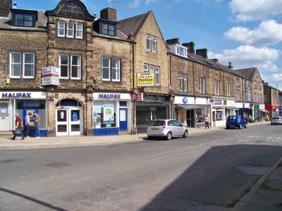
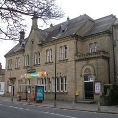
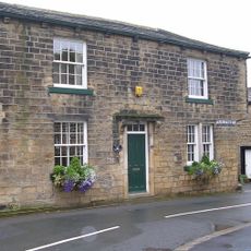
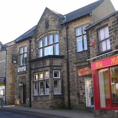
Guiseley is a residential town northwest of Leeds near Leeds Bradford Airport, featuring residential neighborhoods, parks, and retail areas. The town center combines shopping zones with everyday stores and green spaces for walking and daily activities.

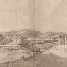
The name first appeared in an eleventh-century document as Gislicleh, derived from an Old English term for a clearing. The area later developed into a residential community during the modern industrial expansion of the region.

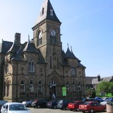
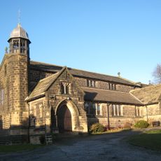
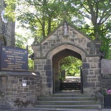
St Oswald's Church holds records of marriages from notable families, including the Longfellows and the Brontë family in earlier centuries.

The town connects to Leeds and Bradford through regular train services, making travel convenient for commuters. Two retail parks with stores like Next and TKMaxx provide shopping options for everyday needs.

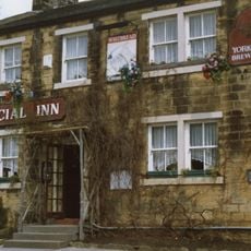
Harry Ramsden opened his first fish and chip restaurant here in 1928, creating a local starting point that later spread across the country. The restaurant remains a memory of where this popular chain began.

The community of curious travelers

AroundUs brings together thousands of curated places, local tips, and hidden gems, enriched daily by 60,000 contributors worldwide.

Start exploring
Location
Shares border with
Menston
GPS coordinates
53.87500,-1.70600
Latest update
December 20, 2025 14:20
Around this place
High Royds Hospital
United Kingdom

High Royds Hospital

2 km
Yeadon Town Hall
United Kingdom

Yeadon Town Hall

1.7 km
Church of St Oswald
United Kingdom

Church of St Oswald

26 m
Esholt Priory
United Kingdom

Esholt Priory

2.5 km
Guiseley Theatre
United Kingdom

Guiseley Theatre

333 m
Church of St Andrew
United Kingdom

Church of St Andrew

1.6 km
Hawksworth Hall
United Kingdom

Hawksworth Hall

2.6 km
Church of St Paul
United Kingdom

Church of St Paul

2.3 km
Trinity Church
United Kingdom

Trinity Church

2.2 km
The Commercial Inn
United Kingdom

The Commercial Inn

2.2 km
Yeadon Library
United Kingdom

Yeadon Library

1.7 km
Rawdon Community Library
United Kingdom

Rawdon Community Library

2.7 km
Esholt Viaduct
United Kingdom

Esholt Viaduct

2.1 km
Guiseley War Memorial Garden
United Kingdom

Guiseley War Memorial Garden

133 m
Guiseley Library
United Kingdom

Guiseley Library

356 m
Trinity Church Sunday School
United Kingdom

Trinity Church Sunday School

2.2 km
Lychgate to Church of St Oswald
United Kingdom

Lychgate to Church of St Oswald

51 m
Guidestone, Victoria Road, N of tunnel under L&B airport runway, jct of Warren House Lane
United Kingdom

Guidestone, Victoria Road, N of tunnel under L&B airport runway, jct of Warren House Lane

2.7 km
K6 Telephone Kiosk Outside Number 21 (The Post Office)
United Kingdom

K6 Telephone Kiosk Outside Number 21 (The Post Office)

2.2 km
Cup and ring marked rock known as the Knotties Stone on Otley Chevin, 270m north east of The Royalty public house
United Kingdom

Cup and ring marked rock known as the Knotties Stone on Otley Chevin, 270m north east of The Royalty public house

2.5 km
Gate Lodge And Gate Piers To Park Gate House
United Kingdom

Gate Lodge And Gate Piers To Park Gate House

1 km
Milestone, Victoria Avenue; TI north of tunnel under L&B airport runway
United Kingdom

Milestone, Victoria Avenue; TI north of tunnel under L&B airport runway

2.7 km
13-21, Main Street
United Kingdom

13-21, Main Street

2.2 km
Yeadon Liberal Club
United Kingdom

Yeadon Liberal Club

1.8 km
Milestone, Bradford Road nr Post office, S of Tranmere Drive
United Kingdom

Milestone, Bradford Road nr Post office, S of Tranmere Drive

1.3 km
Milestone, Harrogate Road, Rawdon
United Kingdom

Milestone, Harrogate Road, Rawdon

2.5 km
Milestone, New Road, Yeadon
United Kingdom

Milestone, New Road, Yeadon

1.6 km
Milestone, Otley Road, Hollins Hill, Hawkswood
United Kingdom

Milestone, Otley Road, Hollins Hill, Hawkswood

1.8 km
Show the full map
Reviews
Share your experience

No review yet

Discussions
Start a discussion...

No discussion yet

« Guiseley - Residential town in Leeds, United Kingdom » is provided by Around Us (aroundus.com). Images and texts are derived from Wikimedia project under a Creative Commons license. You are allowed to copy, distribute, and modify copies of this page, under the conditions set by the license, as long as this note is clearly visible.

Discover hidden gems everywhere you go!

From secret cafés to breathtaking viewpoints, skip the crowded tourist spots and find places that match your style. Our app makes it easy with voice search, smart filtering, route optimization, and insider tips from travelers worldwide. Download now for the complete mobile experience.

Around Us App Screenshot

A unique approach to discovering new places

Le Figaro

All the places worth exploring

France Info

A tailor-made excursion in just a few clicks

20 Minutes

Around Us
Travel Guide & Maps
Download

Send to your phone

QR Code
1

Open the camera app on your mobile.

2

Point at the QR code with your camera. A notification will appear.

3

Tap the notification to open the link.