Rowley Regis, Industrial town in Sandwell, England
Rowley Regis is a town in Sandwell spanning three distinct wards—Blackheath, Cradley Heath, and Old Hill—as part of the Black Country near Birmingham. The area combines hilly terrain with communities shaped by industrial development.
The addition of 'Regis' to the name dates to around 1140, marking a link to royal hunting grounds in medieval England. This royal designation shows the area's importance to the monarchy of that era.
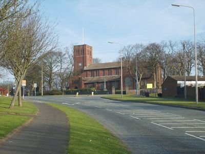
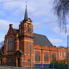
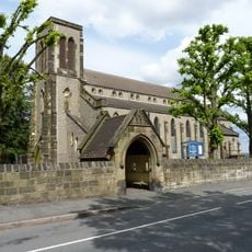
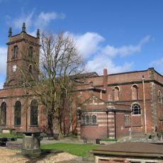
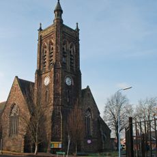
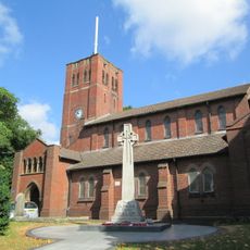
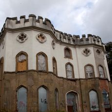
St. Giles Church, built in 1923, is the third place of worship on this site after two earlier buildings were destroyed. The location reflects how the community rebuilt and adapted through periods of industrial change.
The railway station, operational since 1867, provides regular connections to Birmingham and other West Midlands destinations via local train services. Visitors can easily arrive by public transport and explore the surrounding area.
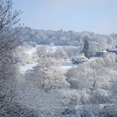
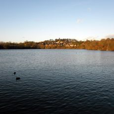
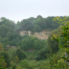
Turner's Hill within the Rowley Hills reaches 269 meters elevation and stands as the highest point across the entire West Midlands region. This geographic distinction offers visitors who climb it far-reaching views over the surrounding landscape.
Location: Sandwell
GPS coordinates: 52.48000,-2.06000
Latest update: December 7, 2025 10:02
Round Oak Steelworks
3.7 km
The Leasowes
3.5 km
Netherton Reservoir
2.4 km
Cradley Heath Baptist Church
1.5 km
Church of St. Thomas and St Luke, Dudley
3.7 km
Cobb's Engine House
1.6 km
Parkhead Viaduct
3.4 km
Saltwells Local Nature Reserve
2.6 km
St John's Church, Dudley
3.3 km
Church of St Andrew
2.5 km
Bumble Hole Local Nature Reserve
1.6 km
Warren's Hall Country Park
1.6 km
Church of St. Edmund, Dudley
3.8 km
Doulton's Claypit
2.4 km
Majestic Cinema, Cradley Heath
2 km
Church of St John the Baptist, Halesowen
3.4 km
St Giles
1.1 km
Church of the Holy Trinity
807 m
War Memorial Outside St Giles' Church, Rowley Regis
1.1 km
Odeon Dudley (Merry Hill)
3.3 km
Haden Hill Hall, Haden Hill Park
1.4 km
Corngreaves Hall
2.1 km
Halesowen War Memorial
3.3 km
Cradley Heath Library
1.2 km
Towpath Bridge, Approximately 300 Metres North West Of Highbridge Road
2.8 km
Provision House
3.7 km
Footbridge over Netherton Tunnel Branch at Windmill End
1.5 km
Whitefriars
3.3 kmVisited this place? Tap the stars to rate it and share your experience / photos with the community! Try now! You can cancel it anytime.
Discover hidden gems everywhere you go!
From secret cafés to breathtaking viewpoints, skip the crowded tourist spots and find places that match your style. Our app makes it easy with voice search, smart filtering, route optimization, and insider tips from travelers worldwide. Download now for the complete mobile experience.
A unique approach to discovering new places❞
— Le Figaro
All the places worth exploring❞
— France Info
A tailor-made excursion in just a few clicks❞
— 20 Minutes