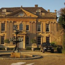
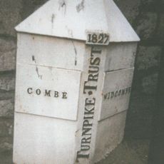
Prior Park Landscape Garden, English garden in Bath, England
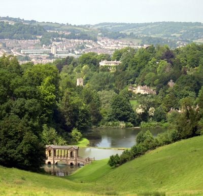
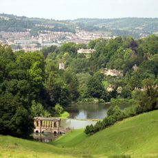
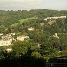
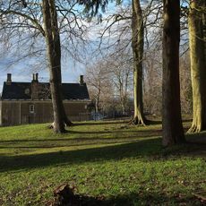
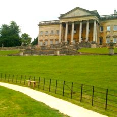
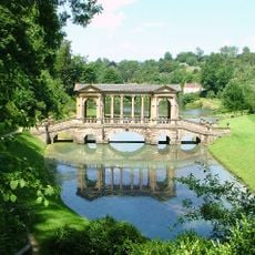
Prior Park is a garden on a hillside overlooking Bath with winding paths, water features, and a Palladian bridge spanning a lake. The 28-acre property includes different areas with temples, open meadows, and tree clusters that work together to create a balanced garden layout.
The garden was created in the mid-1700s when European gardens were shifting from strict geometric designs to more naturalistic landscapes. This shift in style influenced how gardens were designed in the following decades across the continent.
The garden shows a love of nature through its curved paths and carefully placed trees that guide your eye across the landscape. Classical buildings like the bridge feel like natural parts of the scenery rather than added structures.
The garden sits on a hillside, so wear comfortable shoes and allow time to explore the different sections at your own pace. A tea cabin near the lower entrance offers refreshments and a place to rest between walks.
The bridge is one of only four Palladian structures of this type still standing in the world and shows a rare architectural form. Visitors often miss how seamlessly it fits into the natural landscape despite being a substantial building.
Location: Bath and North East Somerset
Inception: 18 century
Founders: Ralph Allen
Architects: Alexander Pope, Lancelot Brown
Website: https://nationaltrust.org.uk/prior-park-landscape-garden
GPS coordinates: 51.36720,-2.34374
Latest update: December 8, 2025 19:57
Prior Park
250 m
Widcombe Manor House
741 m
Combe Down and Bathampton Down Mines
682 m
Bath Abbey Cemetery
443 m
Crowe Hall
797 m
St Thomas à Becket Church, Widcombe
717 m
Widcombe Crescent
981 m
Church of the Holy Trinity
907 m
83-101, Church Road
871 m
Fountain At Widcombe Manor House
712 m
Anglican Cemetery Chapel, St Mary's Churchyard
961 m
Stable And Coach House Block Of Lycombe House
911 m
Lyncombe Hall
871 m
National Westminster Bank
881 m
Mortuary Chapel In Abbey Cemetery
480 m
Bridge Over Footpath Between Fersfield And Prior Park Farm Woods
359 m
Vale View House
952 m
Parish Boundary Marker at ST7559762404
964 m
East Wing And Porte Cochere
260 m
Lonsdale
880 m
Palladian Bridge In Grounds Of Prior Park
171 m
Claremont House, With Front Boundary Walls And Piers
868 m
Milepost At St760641
863 m
Lower Lodge, With Walls, Railings And Piers
664 m
Boundary Marker Opposite Macauley Buildings
770 m
Gate Piers At South End Of Ralph Allen Drive
519 m
Combe Ridge
961 m
Milepost, Widcombe Hill, by "Greenlea"
861 mVisited this place? Tap the stars to rate it and share your experience / photos with the community! Try now! You can cancel it anytime.
Discover hidden gems everywhere you go!
From secret cafés to breathtaking viewpoints, skip the crowded tourist spots and find places that match your style. Our app makes it easy with voice search, smart filtering, route optimization, and insider tips from travelers worldwide. Download now for the complete mobile experience.
A unique approach to discovering new places❞
— Le Figaro
All the places worth exploring❞
— France Info
A tailor-made excursion in just a few clicks❞
— 20 Minutes