Enable Location

We need your location to show you interesting places around you

Discover nearby places

Find interesting locations and hidden gems around you

Precise directions

Get accurate directions and distances to places

Your location is never shared with other users. It's only used when you tap the location button.

Birmingham Cross-City Line

Log in to your account

Start exploring — it's free

Trusted by 63,380 travelers worldwide

Continue with Google
Continue with Apple
or

We will send you a code to connect

By continuing, you accept our Terms and Conditions and our Privacy Policy

Check your inbox

We've sent a pincode in your inbox. Please enter the code below.

Birmingham Cross-City Line
Discussion Reviews 1 Photos
20.3k Popularity

Birmingham Cross-City Line, railway line in Birmingham, UK

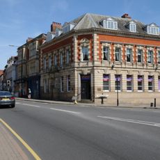
The Birmingham Cross-City Line is a railway route in the West Midlands stretching roughly 50 kilometers through Birmingham's suburbs and neighboring towns. It connects Lichfield in the north with Bromsgrove and Redditch in the south, passing through stations including University and Five Ways as it runs through the city.

The route was assembled from several older railway lines built by different companies in the 1800s, with parts dating back to the 1830s. In the 1970s local authorities decided to combine these separate lines into a single connection, which officially opened as the Cross-City Line in 1978.

The line's name reflects its role in connecting different parts of Birmingham across the city. Today it serves as part of daily life for commuters, students, and travelers moving between neighborhoods and surrounding areas.

Trains run regularly in both directions, with up to four services per hour between major stations during peak times. Stations range from large hubs like Birmingham New Street to smaller suburban stops, making it straightforward to reach different parts of the city and surrounding areas.

The line was electrified in 1994, replacing older diesel trains with modern electric units that made the service quieter and cleaner. This modernization enabled more frequent services and better conditions for commuters and passengers.

The community of curious travelers

AroundUs brings together thousands of curated places, local tips, and hidden gems, enriched daily by 60,000 contributors worldwide.

Start exploring
Location
Official opening
1978
Operator
London Midland
Part of
National Rail
GPS coordinates
52.58910,-1.83409
Latest update
February 16, 2026 21:40
Around this place
Sutton Park
United Kingdom

Sutton Park

3.3 km
Icknield Street
United Kingdom

Icknield Street

3.4 km
Holy Trinity Church, Sutton Coldfield
United Kingdom

Holy Trinity Church, Sutton Coldfield

3 km
Sutton Coldfield Town Hall
United Kingdom

Sutton Coldfield Town Hall

2.6 km
Moat House
United Kingdom

Moat House

2.5 km
Little Aston Hall
United Kingdom

Little Aston Hall

2.9 km
All Saints Church
United Kingdom

All Saints Church

518 m
St James' Church
United Kingdom

St James' Church

699 m
Odeon Cinema, Sutton Coldfield
United Kingdom

Odeon Cinema, Sutton Coldfield

3.7 km
Church of St Peter
United Kingdom

Church of St Peter

2.5 km
Four Oaks Methodist Church
United Kingdom

Four Oaks Methodist Church

1.1 km
Church of St Mary and St Giles and All Saints
United Kingdom

Church of St Mary and St Giles and All Saints

3.1 km
Church House
United Kingdom

Church House

2.9 km
Park House
United Kingdom

Park House

2.6 km
Four Oaks War Memorial Outside the Church of All Saints
United Kingdom

Four Oaks War Memorial Outside the Church of All Saints

546 m
Sutton Coldfield War Memorial
United Kingdom

Sutton Coldfield War Memorial

2.7 km
Medieval deerpark and other archaeological remains in Sutton Park
United Kingdom

Medieval deerpark and other archaeological remains in Sutton Park

2.3 km
Streetly War Memorial Cross Outside All Saints' Church
United Kingdom

Streetly War Memorial Cross Outside All Saints' Church

3.2 km
Sutton Coldfield Library
United Kingdom

Sutton Coldfield Library

3.1 km
Collets Brook Farmhouse
United Kingdom

Collets Brook Farmhouse

3.1 km
Milepost At Sk 094 005
United Kingdom

Milepost At Sk 094 005

2.4 km
14, High Street
United Kingdom

14, High Street

2.8 km
Post box B73 326
United Kingdom

Post box B73 326

3.6 km
Milepost, new road, nr Lamb Farm (moved from SP996146)
United Kingdom

Milepost, new road, nr Lamb Farm (moved from SP996146)

3.2 km
Gate Piers With Attached Wall, Railings And Gates At Main Entrance To Little Aston Hall
United Kingdom

Gate Piers With Attached Wall, Railings And Gates At Main Entrance To Little Aston Hall

2.3 km
Milepost, Chester Road, Streetly, between Bridle Lane & Foley Road jct
United Kingdom

Milepost, Chester Road, Streetly, between Bridle Lane & Foley Road jct

3.6 km
Milepost, Walsall Road, by No. 138 , E of jct with A452 (Old Irish Harp PH) in Aldridge Road
United Kingdom

Milepost, Walsall Road, by No. 138 , E of jct with A452 (Old Irish Harp PH) in Aldridge Road

3.7 km
Milepost, Shenstone Woodend, 40m S of jct with Pimfold Hill
United Kingdom

Milepost, Shenstone Woodend, 40m S of jct with Pimfold Hill

2.7 km
Show the full map
Reviews
Share your experience

No review yet

Discussions
Start a discussion...

No discussion yet

« Birmingham Cross-City Line - railway line in Birmingham, UK » is provided by Around Us (aroundus.com). Images and texts are derived from Wikimedia project under a Creative Commons license. You are allowed to copy, distribute, and modify copies of this page, under the conditions set by the license, as long as this note is clearly visible.

Discover hidden gems everywhere you go!

From secret cafés to breathtaking viewpoints, skip the crowded tourist spots and find places that match your style. Our app makes it easy with voice search, smart filtering, route optimization, and insider tips from travelers worldwide. Download now for the complete mobile experience.

Around Us App Screenshot

A unique approach to discovering new places

Le Figaro

All the places worth exploring

France Info

A tailor-made excursion in just a few clicks

20 Minutes

Around Us
Travel Guide & Maps
Download

Send to your phone

QR Code
1

Open the camera app on your mobile.

2

Point at the QR code with your camera. A notification will appear.

3

Tap the notification to open the link.