Icknield Street, Roman road in Warwickshire, England
Icknield Street is an ancient Roman road that runs through Warwickshire, South Yorkshire, Gloucestershire, and Staffordshire. It served as a major transportation link connecting different parts of Roman Britain for military and commercial travel.
The road was built around 43 CE by Roman forces during their invasion of Britain. It remained in use for centuries, connecting military posts and trading centers across the region.
Medieval communities renamed sections of the road, including the Haydon Way stretch between Studley and Alcester in Warwickshire.
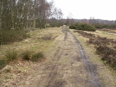
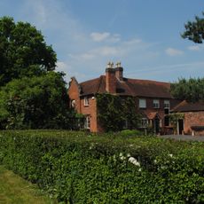
Today visitors can explore sections of the road by walking through the countryside along its historical route. The best time to visit is during dry weather when the ancient surface is easiest to see and walk upon.
Excavations have uncovered medieval pottery fragments scattered along the Warwickshire stretch, showing the route continued being used long after the Romans left. Local place names like Haydon Way between Studley and Alcester echo how later communities renamed and repurposed the road.
Location: Warwickshire
Location: South Yorkshire
Location: Gloucestershire
Location: Staffordshire
GPS coordinates: 52.57170,-1.87602
Latest update: December 7, 2025 20:25
Sutton Park
1.9 km
Great Barr Hall
3.5 km
Lunar Society Moonstones
3.1 km
Sutton Coldfield Town Hall
3.5 km
Maryvale Institute
2.8 km
Odeon, Kingstanding
2.1 km
Little Aston Hall
3.3 km
King's Standing Bowl Barrow
1.6 km
All Saints Church
2.9 km
Saint Columba's
1.7 km
Church of St Peter
3.4 km
Four Oaks Methodist Church
3.3 km
Park House
2.9 km
Four Oaks War Memorial Outside the Church of All Saints
2.9 km
Sutton Coldfield War Memorial
3.6 km
All Saints' Church
2.7 km
Medieval deerpark and other archaeological remains in Sutton Park
1.4 km
Pheasey Library
2.6 km
Streetly War Memorial Cross Outside All Saints' Church
1.4 km
St Mark's Church, Kingstanding
2 km
Living Proof church
2.2 km
Post box B73 259D
2.4 km
Doe Bank Farmhouse And Farm Building Attached
1.6 km
Gate Piers With Attached Wall, Railings And Gates At Main Entrance To Little Aston Hall
2.7 km
Post box B73 326
3.4 km
Milepost, Chester Road, Streetly, between Bridle Lane & Foley Road jct
1.2 km
Milepost, Walsall Road, by No. 138 , E of jct with A452 (Old Irish Harp PH) in Aldridge Road
3.4 km
St Mary's College, Oscott
3.2 kmVisited this place? Tap the stars to rate it and share your experience / photos with the community! Try now! You can cancel it anytime.
Discover hidden gems everywhere you go!
From secret cafés to breathtaking viewpoints, skip the crowded tourist spots and find places that match your style. Our app makes it easy with voice search, smart filtering, route optimization, and insider tips from travelers worldwide. Download now for the complete mobile experience.
A unique approach to discovering new places❞
— Le Figaro
All the places worth exploring❞
— France Info
A tailor-made excursion in just a few clicks❞
— 20 Minutes