Albert Embankment

Log in to your account

AroundUs is a community-driven map of interesting places, built by curious explorers like you. It grows with every review, story, and photo you share.
Connect to save your favorite spots, contribute locations, and create personalized routes.
By continuing, you accept our Terms and Conditions and our Privacy Policy

Albert Embankment

Add to collection
Map
Suggest a change
Share

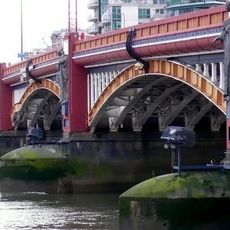
Albert Embankment, Riverside footpath and road in Lambeth, England
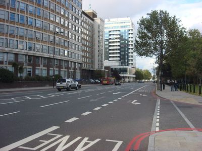
Albert Embankment extends one mile along the south bank of River Thames from Vauxhall Bridge to Westminster Bridge in Central London.

The Metropolitan Board of Works commenced construction in September 1865, opening the embankment in May 1868 to create a new highway and riverfront.

The embankment features traditional sturgeon lamp standards designed by George Vulliamy, reflecting Victorian engineering and architectural elements.

The footpath section provides continuous public access along the Thames, connecting major bridges and offering direct routes to nearby transport connections.

White Hart Draw Dock, incorporated into Albert Embankment, maintains its original 14th-century slipway through underground tunnels beneath the structure.

Location: London Borough of Lambeth

GPS coordinates: 51.48946,-0.12743

Latest update: May 23, 2025 21:09

Around this place
Show the full map
SIS Building
United Kingdom

SIS Building

336 m
Tate Britain
United Kingdom

Tate Britain

180 m
Vauxhall Bridge
United Kingdom

Vauxhall Bridge

221 m
Marsham Court
United Kingdom

Marsham Court

455 m
Peel House
United Kingdom

Peel House

366 m
Morpeth Arms
United Kingdom

Morpeth Arms

92 m
Statue of John Everett Millais
United Kingdom

Statue of John Everett Millais

196 m
Locking Piece
United Kingdom

Locking Piece

15 m
Bessborough Gardens
United Kingdom

Bessborough Gardens

216 m
Two Piece Reclining Figure No. 1
United Kingdom

Two Piece Reclining Figure No. 1

83 m
Roller Skater
United Kingdom

Roller Skater

491 m
The Rising Tide
United Kingdom

The Rising Tide

234 m
Millbank Barracks North West Range, Royal Army Medical Corps
United Kingdom

Millbank Barracks North West Range, Royal Army Medical Corps

173 m
Maclise House, Millbank Estate
United Kingdom

Maclise House, Millbank Estate

350 m
2 Bessborough Street and 33 Vauxhall Bridge Road, including selected hard landscaping and boundary walls
United Kingdom

2 Bessborough Street and 33 Vauxhall Bridge Road, including selected hard landscaping and boundary walls

392 m
River Wall With 28 Lamp Standards From Lambeth Bridge To West Of Alembic House
United Kingdom

River Wall With 28 Lamp Standards From Lambeth Bridge To West Of Alembic House

388 m
Leighton House, Millbank Estate
United Kingdom

Leighton House, Millbank Estate

225 m
Four Public Benches On Embankment Footpath Immediately North Of Alembic House
United Kingdom

Four Public Benches On Embankment Footpath Immediately North Of Alembic House

280 m
Officers Mess And Commandants House of Royal Army Medical College
United Kingdom

Officers Mess And Commandants House of Royal Army Medical College

69 m
Millbank Barracks South West Range, Royal Army Medical College
United Kingdom

Millbank Barracks South West Range, Royal Army Medical College

125 m
Thorndike House Lillington Gardens Estate With Attached Walls And Steps
United Kingdom

Thorndike House Lillington Gardens Estate With Attached Walls And Steps

415 m
Tate Gallery Gates, Railings And Gatepiers
United Kingdom

Tate Gallery Gates, Railings And Gatepiers

151 m
Wisley House Lillington Gardens Estate With Attached Walls And Steps
United Kingdom

Wisley House Lillington Gardens Estate With Attached Walls And Steps

448 m
Royal Army Medical College Southern Block
United Kingdom

Royal Army Medical College Southern Block

112 m
9-19, Bessborough Street Sw1
United Kingdom

9-19, Bessborough Street Sw1

399 m
K6 Telephone Kiosk outside of Tate Britain
United Kingdom

K6 Telephone Kiosk outside of Tate Britain

117 m
Lawrence House, Millbank Estate
United Kingdom

Lawrence House, Millbank Estate

218 m
Hogarth House
United Kingdom

Hogarth House

332 m
Show the full map

Reviews

Visited this place? Tap the stars to rate it and share your experience / photos with the community! Try now! You can cancel it anytime.

« Albert Embankment: Riverside footpath and road in Lambeth, England » is provided by Around Us (aroundus.com). Images and texts are derived from Wikimedia project under a Creative Commons license. You are allowed to copy, distribute, and modify copies of this page, under the conditions set by the license, as long as this note is clearly visible.

Discover hidden gems everywhere you go!

From secret cafés to breathtaking viewpoints, skip the crowded tourist spots and find places that match your style. Our app makes it easy with voice search, smart filtering, route optimization, and insider tips from travelers worldwide. Download now for the complete mobile experience.

Around Us App Screenshot

A unique approach to discovering new places

Le Figaro

All the places worth exploring

France Info

A tailor-made excursion in just a few clicks

20 Minutes