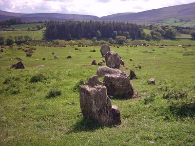
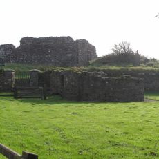
Aughlish, Archaeological site in County Londonderry, Northern Ireland.
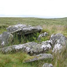
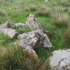
Aughlish is an archaeological site in County Londonderry featuring six stone circles and two megalithic alignments scattered across the rural landscape. These formations consist of various stones arranged in geometric patterns that demonstrate careful planning and construction.
The site dates from the Bronze Age and shows construction methods that were refined over generations. The combination of different circular and linear structures suggests the place was used for various purposes throughout its long occupation.
The arrangement of these stones reveals how early inhabitants oriented their sacred spaces according to celestial patterns and sky movements. This placement shows that observing the heavens held deep meaning in their daily rituals and beliefs.
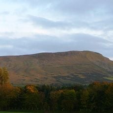
The site lies in open countryside and can be visited without paid entry, though sturdy footwear is essential given the uneven ground and natural terrain. Having a map or guide beforehand helps identify all the structures since they are spread across a larger area.
Two of the linear structures intersect in an unusual way, forming a complex pattern that may not be fully understood even today. This crossing arrangement is rare and suggests the place held special significance for those who built it.
Location: County Londonderry
Location: Aughlish
GPS coordinates: 54.89600,-7.04100
Latest update: December 12, 2025 14:25
Peace Bridge
20.9 km
St Columb's Cathedral
21.1 km
Guildhall, Derry
21.1 km
Foyle Bridge
21.1 km
Craigavon Bridge
20.6 km
Sawel Mountain
8.5 km
Diamond War Memorial
21.1 km
HMS Ferret
20.7 km
Dungiven Castle
8.3 km
Altinaghree Castle
13.2 km
Foyle Valley Railway
20.9 km
Roe Valley Country Park
15.8 km
Benbradagh
12 km
Tower Museum
21.1 km
Roe Valley Arts & Cultural Centre
18.2 km
Clogherny Meenerrigal
17 km
Court Tomb von Ervey
12 km
Limavady Baptist Church
17.9 km
Straidarran House Clagan Road Claudy Co Londonderry Bt47 4db
3.1 km
Artillery Street Theatre
21 km
The Playhouse, Derry
21 km
St. Columba's Church Draperstown Magherafelt Co.londonderry
20 km
Roe Valley Hospital (former Workhouse) Benevenagh Avenue Limavady Co Londonderry Bt49 Oaq
18 km
Glencush Bridge Ballyheather Road Strabane Co.tyrone Bt82
20 km
Methodist Church
20.9 km
Ballykelly Presbyterian Church Main Street Ballykelly Limavady Co Londonderry Bt49 9hs
16.5 km
Banagher Old Church
6 km
Northern Bank 6 Shipquay Place Londonderry
21.1 kmVisited this place? Tap the stars to rate it and share your experience / photos with the community! Try now! You can cancel it anytime.
Discover hidden gems everywhere you go!
From secret cafés to breathtaking viewpoints, skip the crowded tourist spots and find places that match your style. Our app makes it easy with voice search, smart filtering, route optimization, and insider tips from travelers worldwide. Download now for the complete mobile experience.
A unique approach to discovering new places❞
— Le Figaro
All the places worth exploring❞
— France Info
A tailor-made excursion in just a few clicks❞
— 20 Minutes