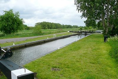
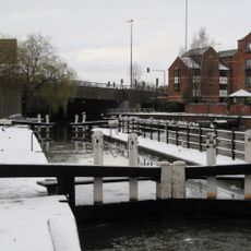
Fobney Lock, Navigation lock at Small Mead, Reading, United Kingdom
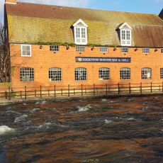
Fobney Lock is a navigation lock on the River Kennet near Reading that separates an engineered channel cutting Fobney Island from the main river flow. The structure contains gates and a chamber that allow boats to move between different water levels.
The lock was built between 1718 and 1723 by engineer John Hore from Newbury as part of the Kennet Navigation scheme. It formed part of a larger effort to make the river more navigable for freight transport and trading vessels.
The lock connects Reading to other river communities through the Kennet Navigation network, still used by boat owners today. It shows how people once engineered waterways to move goods and link distant places.
Visitors can best explore the lock on foot by following the towpath, which offers clear access to the site. The best time to visit is during stable weather, as the surrounding area becomes safer and more pleasant to walk through.
The adjacent Fobney Island was turned into a wetland reserve in 2013 with reed beds and meadows that shelter numerous bird species. Today visitors walking past the lock can observe wildlife and their habitats up close.
The community of curious travelers
AroundUs brings together thousands of curated places, local tips, and hidden gems, enriched daily by 60,000 contributors worldwide.