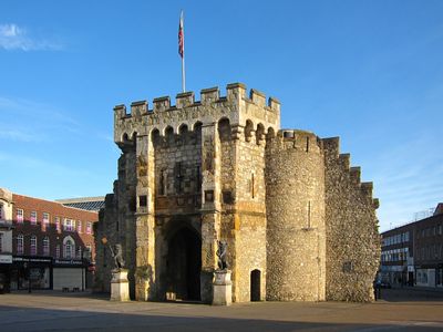
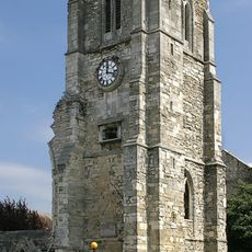
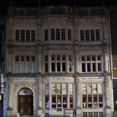
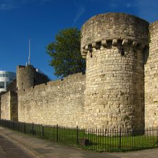
Bargate, Medieval city gate in Southampton, England
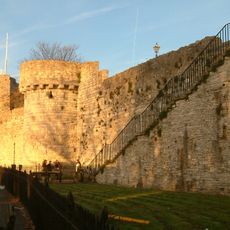
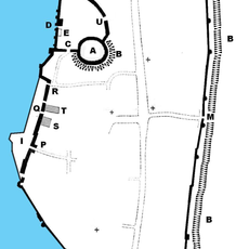
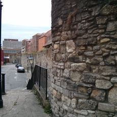
The Bargate is a medieval city gate with two cylindrical stone towers, arrow slit windows, and flint walls rising above a central passageway. The structure defines the northern boundary of the historic fortifications and connects two sections of the city.
The gate was built around 1180 and served as the main entrance, guildhall, courthouse, and prison, including for Genoese captives during a conflict. Over the centuries, it shaped the city's identity and later became a symbol of urban power.
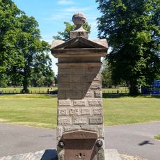
The north side displays eleven heraldic shields from prominent families, along with lead lion sculptures and an 18th-century sundial. These decorations tell the story of the gate's importance to the city and its ruling families.
Pedestrians can walk through the ground floor passage, as the structure marks the northern start of the shopping street. Access is straightforward from public areas and offers an easy route through the historic walls.
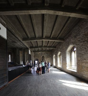
The upper chamber stored gunpowder during times of conflict and later served as an air raid warden station. This dual purpose shows how the building adapted to different security needs across modern times.
Location: City of Southampton
Floors above the ground: 2
Part of: Southampton town walls
GPS coordinates: 50.90270,-1.40413
Latest update: December 7, 2025 20:45
Southampton town walls
393 m
Southampton Tudor House and Garden
369 m
Southampton Castle
193 m
Red Lion Inn
414 m
Holyrood Church
341 m
Above Bar Church, Southampton
280 m
St. Michael's Church, Southampton
354 m
Dolphin Hotel
292 m
King John's Palace
398 m
St Joseph Church, Southampton
394 m
Palmerston's Monument
422 m
Midland Bank Limited
135 m
Star Hotel
214 m
National Westminster Bank
345 m
Bugle House
413 m
County Court
169 m
56, High Street
425 m
Gas Lamp
363 m
Drinking Fountain
202 m
Lansdowne House
187 m
Section Of Wall Running West From Polymond Tower To Remains Of Semi-circular Tower To East Of Bargate And Small Part South Of Po
95 m
Barclays Bank Ltd
99 m
6, High Street
62 m
5, St Michael's Square
377 m
48, Bugle Street
381 m
Gas Column (Situated On A Traffic Roundabout At The Junction Of Hanover Buildings, Houndwell Place, Palmerstone Road And Queens Way)
224 m
Town wall: section from 75yds (70m) E of Arundel Tower to limit of castle site including Arundel and Catchcold Towers
137 m
Sections of wall running south along Esplanade from south-west corner of Simnel Street to University Air Squadron Headquarters at south end of Bugle Street. Includes The Arcades, The West Gate, Blue Anchor Postern and Biddles Gate
426 mVisited this place? Tap the stars to rate it and share your experience / photos with the community! Try now! You can cancel it anytime.
Discover hidden gems everywhere you go!
From secret cafés to breathtaking viewpoints, skip the crowded tourist spots and find places that match your style. Our app makes it easy with voice search, smart filtering, route optimization, and insider tips from travelers worldwide. Download now for the complete mobile experience.
A unique approach to discovering new places❞
— Le Figaro
All the places worth exploring❞
— France Info
A tailor-made excursion in just a few clicks❞
— 20 Minutes