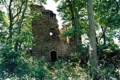
Burradon Tower, Tower house in Burradon, North Tyneside, England.
Burradon Tower is a three-story square stone tower featuring defensive design elements from the 16th century. The structure displays typical characteristics of fortified towers in northern England, with thick walls and functional openings.
Bertram Anderson built the tower in 1553 after his uncle John Orde acquired the Manor of Burradon. The construction represented a period of building activity that brought new fortified structures to the region.
The fireplace bears the inscription 'LO' and the date 1633, marking when the Ogle family made improvements to the building. This carved detail tells us how residents adapted and modified the tower for their own needs.
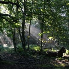
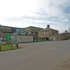
The tower stands on Burradon Farm grounds and is reached by marked pathways through the property. Visitors should expect uneven terrain and be prepared for the weather conditions typical of the coastal region.
The tower was integrated into a farm complex in the 19th century, showing how medieval buildings were repurposed for agricultural work. This transformation reveals the practical ways that old structures adapted to new uses over time.
Location: North Tyneside
GPS coordinates: 55.05100,-1.56893
Latest update: December 9, 2025 20:22
Tyneview Park
4.3 km
Gosforth Park Nature Reserve
3.2 km
Gosforth House
3.3 km
St Bartholomew's Church, Long Benton
3.9 km
British Gas Research Station Including Attached Restaurant Block To South
1.8 km
Sacred Heart Church, North Gosforth
3.5 km
1914-18 War Memorial In St Bartholomew's Churchyard, Longbenton
3.9 km
Church of St Alban
4.4 km
Church of St Nicholas
4 km
Church of St John the Evangelist
2.1 km
Church of the Holy Trinity
2.8 km
Milestone About 150 Metres South Of Church Of Sacred Heart
3.6 km
North Gosforth Chapel
4.2 km
Backworth War Memorial
2.5 km
Entrance Gate Piers To Brandling House And Adjoining Park Walls
3.9 km
Border Minstrel
3.3 km
Cramlington War Memorial in Village Square
4 km
Dial Cottage
2.6 km
Backworth Miners Welfare Hall
2.6 km
Hartley Disaster Memorial North East Of Church Of St Alban, And Surrounding Wall
4.4 km
Drinking Fountain West Of Holywell Manor House
4.4 km
Finger Post
4.3 km
Milepost, Wideopen
3.7 km
Gosforth House, Now Brandling House, Part Of High Gosforth Park Club
3.3 km
Milepost At Junction Of Front Street And Manorfields
4.5 km
Caretaker's Flat, Brandling House
3.3 km
Milepost, Great North Road, Brunton Park
4.3 km
Milepost, Great North Road
3.6 kmVisited this place? Tap the stars to rate it and share your experience / photos with the community! Try now! You can cancel it anytime.
Discover hidden gems everywhere you go!
From secret cafés to breathtaking viewpoints, skip the crowded tourist spots and find places that match your style. Our app makes it easy with voice search, smart filtering, route optimization, and insider tips from travelers worldwide. Download now for the complete mobile experience.
A unique approach to discovering new places❞
— Le Figaro
All the places worth exploring❞
— France Info
A tailor-made excursion in just a few clicks❞
— 20 Minutes