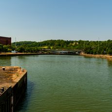
Cumberland Basin, Artificial channel in Hotwells, England.
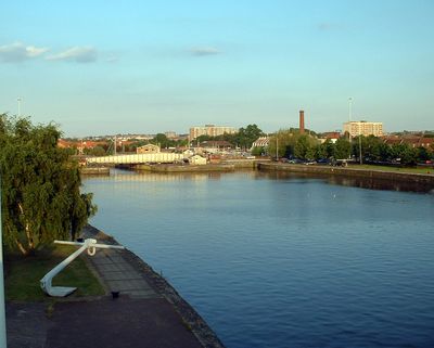
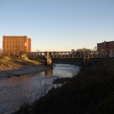
Cumberland Basin is an artificial waterway in Hotwells that connects the River Avon to Bristol's Floating Harbour. The system operates through entrance locks and a network of bridges, including the prominent Plimsoll Swing Bridge that serves both vehicles and pedestrians.
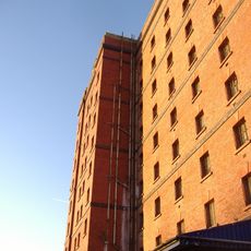
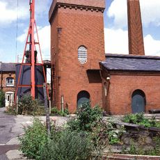
Construction began in 1804 following William Jessop's plans to improve harbor connections and the basin opened in 1809. This engineering project strengthened Bristol's role as a major maritime port and shaped the city's waterfront development.
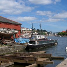
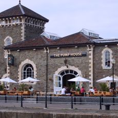
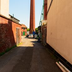
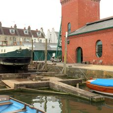
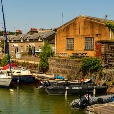
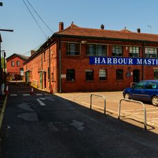
The basin reflects Bristol's shift from a spa destination to a working port, visible in how the space bridges leisure areas with active maritime zones. Local residents and visitors move between restored waterfront buildings and functional harbor spaces that coexist in daily use.
The basin area is accessible through several entry points, with the Plimsoll Swing Bridge serving as the main crossing for both vehicles and pedestrians. Walking along the quay provides good views of the locks and water systems, making it easy to understand how the harbor functions.
The Plimsoll Swing Bridge was originally a purely hydraulic structure, but its system was converted to electro-hydraulic operation in 2010. This transformation shows how the basin's heritage infrastructure has been modernized while keeping its historic appearance intact.
Location: Hotwells
Inception: 1804
GPS coordinates: 51.44810,-2.61944
Latest update: December 10, 2025 16:23
Underfall Yard
221 m
Pump House, Bristol
120 m
Nova Scotia
109 m
B Bond Tobacco Warehouse
212 m
Ashton Avenue Bridge
281 m
Church of Holy Trinity, Hotwells
287 m
Chimney of Hydraulic Engine House
155 m
Underfall yard
166 m
Patent Slip And Quay Walls
175 m
285 and 287 Dowry Parade, Hotwell Road
267 m
The Bear Public House (263) And Attached Ramped Walls And Steps To Number 265
250 m
Plimsoll Swing Bridge
235 m
Numbers 1A And 2A And Attached Front Garden Walls And Piers
109 m
A Bond Tobacco Warehouse
205 m
Hydraulic Engine House
164 m
266 Chapel Row, Hotwell Road
294 m
Numbers 1 And 2 And Attached Front Garden Walls And Piers
118 m
Simon Short Memorial Fountain
234 m
York House And Attached Front Area Railings
296 m
Numbers 6 And 7 And Attached Garden Walls And Piers Numbers 9 To 25 And Attached Garden Walls And Piers
192 m
264 Chapel Row, Hotwell Road
300 m
289 and 291 Dowry Parade, Hotwell Road
257 m
Brunel's South Entrance Lock
286 m
South Junction Lock
154 m
Walls Piers And Gates To South And West Of Church Of Holy Trinity
262 m
3, Merchant's Road
70 m
Machine Shop
248 m
Quay Walls And Bollards Around Cumberland Basin
103 mVisited this place? Tap the stars to rate it and share your experience / photos with the community! Try now! You can cancel it anytime.
Discover hidden gems everywhere you go!
From secret cafés to breathtaking viewpoints, skip the crowded tourist spots and find places that match your style. Our app makes it easy with voice search, smart filtering, route optimization, and insider tips from travelers worldwide. Download now for the complete mobile experience.
A unique approach to discovering new places❞
— Le Figaro
All the places worth exploring❞
— France Info
A tailor-made excursion in just a few clicks❞
— 20 Minutes