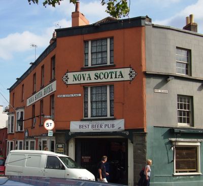
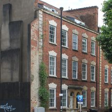
Nova Scotia, Grade II listed pub in City of Bristol, United Kingdom
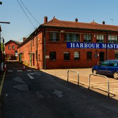
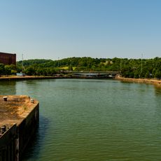
Nova Scotia is a Grade II listed pub standing directly on the waterfront of Bristol Harbor. The building displays Victorian architectural features with original stone and brickwork that remain largely intact from its construction period.
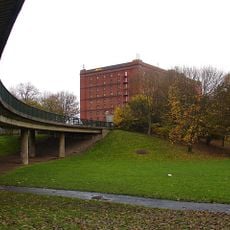
The building was constructed during the 19th century expansion of Bristol Harbor as part of the working waterfront infrastructure. Its Grade II listing came during the post-World War II period when authorities began systematically protecting important structures across the country.
The pub maintains traditional British drinking culture and functions as a gathering place for locals and visitors in the harbor area. You can sample regional ales and experience the relaxed character of a working waterfront establishment.
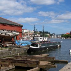
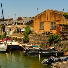
Access is direct from the harborside, and the location offers clear views of the water and passing boats. Any structural changes require approval from local authorities to maintain the protected status of the building.
The pub takes its name from a vessel that once anchored in the harbor and holds a place in Bristol's maritime story. This connection to seafaring remains embedded in the character of the place today.
Location: City of Bristol
GPS coordinates: 51.44726,-2.61863
Latest update: December 12, 2025 09:04
Cumberland Basin
109 m
Underfall Yard
113 m
Pump House, Bristol
131 m
B Bond Tobacco Warehouse
132 m
Ashton Avenue Bridge
261 m
Church of Holy Trinity, Hotwells
362 m
Chimney of Hydraulic Engine House
47 m
Underfall yard
60 m
Patent Slip And Quay Walls
66 m
285 and 287 Dowry Parade, Hotwell Road
371 m
Atyeo
332 m
The Bear Public House (263) And Attached Ramped Walls And Steps To Number 265
349 m
Plimsoll Swing Bridge
326 m
A Bond Tobacco Warehouse
153 m
Numbers 1A And 2A And Attached Front Garden Walls And Piers
12 m
Hydraulic Engine House
56 m
Numbers 6 And 7 And Attached Garden Walls And Piers Numbers 9 To 25 And Attached Garden Walls And Piers
86 m
York House And Attached Front Area Railings
397 m
C Bond Tobacco Warehouse
313 m
289 and 291 Dowry Parade, Hotwell Road
362 m
Numbers 1 And 2 And Attached Front Garden Walls And Piers
16 m
Simon Short Memorial Fountain
317 m
Brunel's South Entrance Lock
363 m
3, Merchant's Road
157 m
Machine Shop
140 m
Walls Piers And Gates To South And West Of Church Of Holy Trinity
341 m
South Junction Lock
78 m
Quay Walls And Bollards Around Cumberland Basin
160 mVisited this place? Tap the stars to rate it and share your experience / photos with the community! Try now! You can cancel it anytime.
Discover hidden gems everywhere you go!
From secret cafés to breathtaking viewpoints, skip the crowded tourist spots and find places that match your style. Our app makes it easy with voice search, smart filtering, route optimization, and insider tips from travelers worldwide. Download now for the complete mobile experience.
A unique approach to discovering new places❞
— Le Figaro
All the places worth exploring❞
— France Info
A tailor-made excursion in just a few clicks❞
— 20 Minutes