Ashton Avenue Bridge
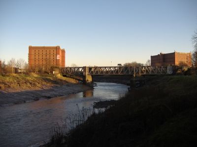
Ashton Avenue Bridge, Grade II listed railway bridge in Bristol, England.
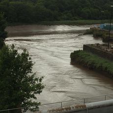
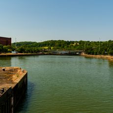
Ashton Avenue Bridge is a listed iron bridge that spans the River Avon with three sections, connecting both riverbanks. The structure now carries guided busway traffic and bicycle paths that serve daily commuters across the city.
The bridge opened in 1906 and was an ambitious infrastructure project that faced significant cost overruns due to engineering challenges. A notable mechanical feature was permanently deactivated in 1951 when hydraulic systems were sealed at the foundations.
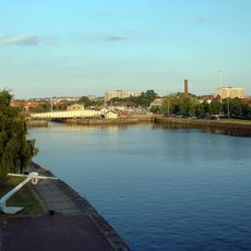
The structure shows early industrial engineering from a time when Bristol was an important transport hub, and it still connects multiple parts of the city today.
The crossing is easily accessible for pedestrians and is used year-round by buses and cyclists. It helps to know that traffic flows regularly and the footpath is well integrated with other transport connections nearby.
The structure originally featured a movable center section that could swing in both directions to allow larger vessels to pass on the river below. This innovative design was later simplified as maritime traffic needs changed.
Location: City of Bristol
Official opening: October 3, 1906
GPS coordinates: 51.44610,-2.62190
Latest update: December 12, 2025 17:41
Cumberland Basin
281 m
Underfall Yard
305 m
Pump House, Bristol
379 m
Nova Scotia
261 m
B Bond Tobacco Warehouse
168 m
Chimney of Hydraulic Engine House
265 m
Underfall yard
291 m
The Bear Public House (263) And Attached Ramped Walls And Steps To Number 265
499 m
Patent Slip And Quay Walls
271 m
285 and 287 Dowry Parade, Hotwell Road
499 m
Plimsoll Swing Bridge
305 m
A Bond Tobacco Warehouse
118 m
Numbers 1A And 2A And Attached Front Garden Walls And Piers
249 m
Hydraulic Engine House
280 m
266 Chapel Row, Hotwell Road
506 m
Simon Short Memorial Fountain
507 m
Numbers 1 And 2 And Attached Front Garden Walls And Piers
248 m
289 and 291 Dowry Parade, Hotwell Road
487 m
264 Chapel Row, Hotwell Road
514 m
C Bond Tobacco Warehouse
221 m
Numbers 6 And 7 And Attached Garden Walls And Piers Numbers 9 To 25 And Attached Garden Walls And Piers
246 m
Former Toll House To Front Of Toll House Court
471 m
Brunel's South Entrance Lock
280 m
Machine Shop
317 m
3, Merchant's Road
350 m
South Junction Lock
336 m
Quay Walls And Bollards Around Cumberland Basin
198 m
Numbers 2 To 9 And Attached Front Basement Area Railings And Piers
524 mVisited this place? Tap the stars to rate it and share your experience / photos with the community! Try now! You can cancel it anytime.
Discover hidden gems everywhere you go!
From secret cafés to breathtaking viewpoints, skip the crowded tourist spots and find places that match your style. Our app makes it easy with voice search, smart filtering, route optimization, and insider tips from travelers worldwide. Download now for the complete mobile experience.
A unique approach to discovering new places❞
— Le Figaro
All the places worth exploring❞
— France Info
A tailor-made excursion in just a few clicks❞
— 20 Minutes