Enable Location

We need your location to show you interesting places around you

Discover nearby places

Find interesting locations and hidden gems around you

Precise directions

Get accurate directions and distances to places

Your location is never shared with other users. It's only used when you tap the location button.

Crowdy Reservoir

Log in to your account

Start exploring — it's free

Trusted by 63,572 travelers worldwide

Continue with Google
Continue with Apple
or

We will send you a code to connect

By continuing, you accept our Terms and Conditions and our Privacy Policy

Check your inbox

We've sent a pincode in your inbox. Please enter the code below.

Crowdy Reservoir
Discussion Reviews 1 Photos
2k Popularity

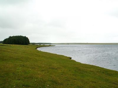
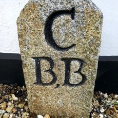
Crowdy Reservoir, lake in the United Kingdom

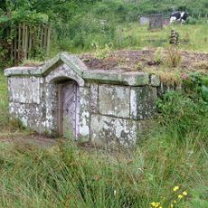
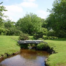
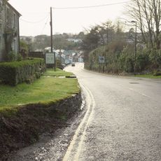
Crowdy Reservoir is a water body in Cornwall situated on Bodmin Moor, spanning roughly 115 acres. The water is surrounded by gentle hills and open moorland, with simple paths and viewing areas that allow visitors to move around while keeping the natural landscape intact.

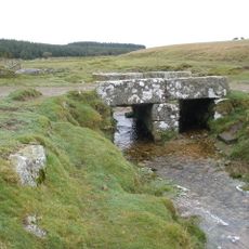
The site was originally a wetland called Crowdy Marsh, feared as a dangerous and forbidding place during the 1800s. A dam was constructed in the 1970s to transform the moorland into a water supply reservoir for the surrounding towns and farms.

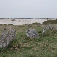
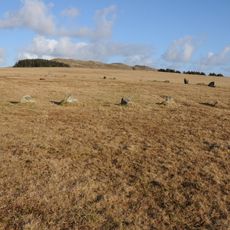
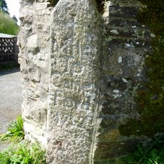
The reservoir sits on Bodmin Moor, a landscape connected to the earliest human settlement in Cornwall. Visitors can sense this connection to the past while walking the shoreline, where ancient stone tools occasionally appear, linking the place to people who lived here thousands of years ago.

The paths around the reservoir are mostly flat and easy to walk, making them suitable for visitors of all ages. Comfortable shoes, weatherproof clothing, and water are recommended, as conditions can change quickly and the trails are exposed to the elements.

When water levels drop during seasonal changes, ancient flint tools occasionally surface along the shoreline, left behind by hunter-gatherers more than 10,000 years ago. These chance discoveries offer glimpses into Cornwall's earliest human history and reveal that people valued this landscape long before the dam was built.

The community of curious travelers

AroundUs brings together thousands of curated places, local tips, and hidden gems, enriched daily by 60,000 contributors worldwide.

Start exploring
Location
Elevation above the sea
286 m
GPS coordinates
50.62222,-4.62222
Latest update
February 9, 2026 08:21
Around this place
RAF Davidstow Moor
United Kingdom

RAF Davidstow Moor

1.5 km
Stannon stone circle
United Kingdom

Stannon stone circle

4.1 km
Fernacre
United Kingdom

Fernacre

3.6 km
Davidstow Airfield and Cornwall at War Museum
United Kingdom

Davidstow Airfield and Cornwall at War Museum

2.8 km
Camelford Library
United Kingdom

Camelford Library

4 km
St Thomas of Canterbury's Church, Camelford
United Kingdom

St Thomas of Canterbury's Church, Camelford

3.9 km
Six cairns on Buttern Hill
United Kingdom

Six cairns on Buttern Hill

3.4 km
Church of St David
United Kingdom

Church of St David

3.7 km
Milestone 120 Metres To North Of Starapark
United Kingdom

Milestone 120 Metres To North Of Starapark

3 km
Methodist Chapel
United Kingdom

Methodist Chapel

3.4 km
RAF Davidstow Moor Memorial Museum
United Kingdom

RAF Davidstow Moor Memorial Museum

2.8 km
The Masons Arms
United Kingdom

The Masons Arms

4 km
Sundial To South Of Church Of St David
United Kingdom

Sundial To South Of Church Of St David

3.7 km
Bowithick Bridge and footbridge
United Kingdom

Bowithick Bridge and footbridge

3.8 km
Holy Well 100m north east of St David's church
United Kingdom

Holy Well 100m north east of St David's church

3.8 km
Milestone Se Of Pendragon House
United Kingdom

Milestone Se Of Pendragon House

3.5 km
Borough Boundary Stone To North 24 Roughtor Road
United Kingdom

Borough Boundary Stone To North 24 Roughtor Road

3.4 km
Milestone To South Of Treblary Cottage
United Kingdom

Milestone To South Of Treblary Cottage

4.1 km
Borough Boundary Stone To West Of No 2 Manor Farm
United Kingdom

Borough Boundary Stone To West Of No 2 Manor Farm

3.9 km
Footbridge To South East Of Bothwick
United Kingdom

Footbridge To South East Of Bothwick

3.8 km
Borough Boundary Stone 30 Metres To North East Of Sewage Works
United Kingdom

Borough Boundary Stone 30 Metres To North East Of Sewage Works

4 km
Manor Farm
United Kingdom

Manor Farm

3.9 km
Foot bridge 900 metres to south east of Roughtor Farm
United Kingdom

Foot bridge 900 metres to south east of Roughtor Farm

1.9 km
Culloden
United Kingdom

Culloden

3.8 km
Davidstow War Memorial
United Kingdom

Davidstow War Memorial

3.7 km
RAF Davidstow Moor WWII Memorial
United Kingdom

RAF Davidstow Moor WWII Memorial

2.8 km
Milestone To South Of No 35
United Kingdom

Milestone To South Of No 35

3.6 km
Milestone, Middle Warren, Trefrew Road
United Kingdom

Milestone, Middle Warren, Trefrew Road

3.8 km
Show the full map
Reviews
Share your experience

No review yet

Discussions
Start a discussion...

No discussion yet

« Crowdy Reservoir - lake in the United Kingdom » is provided by Around Us (aroundus.com). Images and texts are derived from Wikimedia project under a Creative Commons license. You are allowed to copy, distribute, and modify copies of this page, under the conditions set by the license, as long as this note is clearly visible.

Discover hidden gems everywhere you go!

From secret cafés to breathtaking viewpoints, skip the crowded tourist spots and find places that match your style. Our app makes it easy with voice search, smart filtering, route optimization, and insider tips from travelers worldwide. Download now for the complete mobile experience.

Around Us App Screenshot

A unique approach to discovering new places

Le Figaro

All the places worth exploring

France Info

A tailor-made excursion in just a few clicks

20 Minutes

Around Us
Travel Guide & Maps
Download

Send to your phone

QR Code
1

Open the camera app on your mobile.

2

Point at the QR code with your camera. A notification will appear.

3

Tap the notification to open the link.