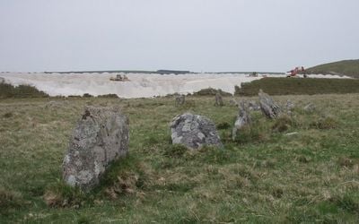
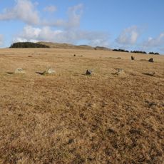
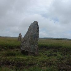
Stannon stone circle, Bronze Age stone circle on Bodmin Moor, Cornwall, England.
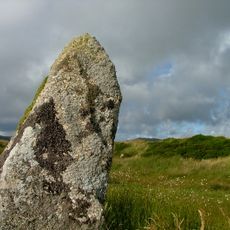
Stannon stone circle is a Bronze Age ring formation on Bodmin Moor in Cornwall containing roughly 77 stones arranged in a slightly flattened pattern on the slopes of Dinnever Hill. The stones vary in height and together create a geometrically notable structure spanning approximately 40 meters across.
The site was built during the Middle Bronze Age as part of a settlement featuring round houses where roughly a hundred people farmed the land. Archaeological digs in the 1960s revealed remains of this prehistoric community.
The stone circle forms part of a ceremonial complex alongside Louden Hill and Fernacre circles, with stones positioned to align with Rough Tor during specific sunrise events.
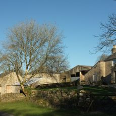
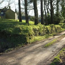
The site is reached via minor country roads from the A30 and a walking path leads between two streams to the circle near Stannon Farm. The location sits on open moorland, so visitors should expect exposed conditions and wear sturdy footwear.
The stone arrangement follows a precise mathematical pattern that reveals careful planning by its prehistoric builders. Some stones stand just half a meter tall while the largest bases exceed one meter wide.
GPS coordinates: 50.58950,-4.65026
Latest update: December 12, 2025 14:25
King Arthur's Hall
2.4 km
Fernacre
2 km
Crowdy Reservoir
4.1 km
Emblance Downs stone circles
2.7 km
Church of St Adwen
2.6 km
Camelford Library
4.2 km
Church of St Brueredus
3.8 km
Helstone Methodist Church
3.8 km
The Masons Arms
4.2 km
Gam Bridge
4.2 km
Guidepost At Junction Of A39T And B3266
3.6 km
Milestone 30 Metres To South East Of Argille House
3.6 km
Milestone 40 Metres To North East Of Worthy Acre Cottage
3.3 km
The Middle Moor Cross, 230m north-east of Camperdown Farm
702 m
Milestone To South Of No 35
4.2 km
The Trevia Cross, at Sportsmans
4.2 km
Milestone 650 Metres To South West Of Trecarne
3.5 km
Clapperbridge To East Of Ivey
3.6 km
Culloden
4.2 km
Borough Boundary Stone 30 Metres To North East Of Sewage Works
3.9 km
Trewint
2.1 km
Foot bridge 900 metres to south east of Roughtor Farm
2.3 km
Farmbuildings Including Granary, Barn And Shippons 20 Metres To North West Of Trewint Farmhouse
2.2 km
White Meadow
2.1 km
Borough Boundary Stone To North 24 Roughtor Road
4 km
Trethin
2.8 km
Borough Boundary Stone To North Of Beech House, Lane End
4.2 km
Milestone, E of Michaelstow Church
4.1 kmVisited this place? Tap the stars to rate it and share your experience / photos with the community! Try now! You can cancel it anytime.
Discover hidden gems everywhere you go!
From secret cafés to breathtaking viewpoints, skip the crowded tourist spots and find places that match your style. Our app makes it easy with voice search, smart filtering, route optimization, and insider tips from travelers worldwide. Download now for the complete mobile experience.
A unique approach to discovering new places❞
— Le Figaro
All the places worth exploring❞
— France Info
A tailor-made excursion in just a few clicks❞
— 20 Minutes