King Arthur's Hall, Archaeological monument in Bodmin Moor, England
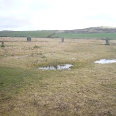
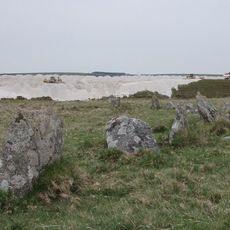
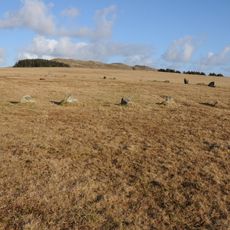
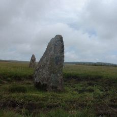
King Arthur's Hall consists of 56 granite stone blocks arranged in a rectangular pattern that forms an enclosure roughly 48 by 20 meters across. The arrangement shows careful planning from prehistoric times.
Archaeological research shows the site dates to the Neolithic period, roughly 5,500 years ago, not the medieval era as was long believed. This finding changed our understanding of how people used this moorland in prehistoric times.
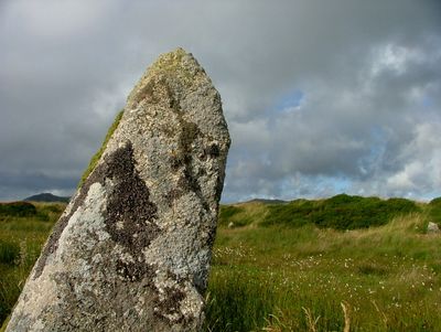
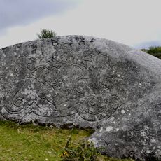
The stones carry the name of legendary King Arthur, showing how the Cornish landscape is deeply woven into medieval British tales. Many visitors come here because of this link to the old stories that have shaped the region for centuries.
The site is reached via walking paths across Bodmin Moor, though sturdy hiking boots are needed because of marshy ground. It helps to check the weather ahead and bring waterproof clothing, as conditions can change quickly.
Beneath the stones, sediment cores were found holding pollen and insect remains from ancient times that reveal details about the environment back then. These scientific clues help researchers understand what the landscape looked like thousands of years ago.
Location: St Breward
GPS coordinates: 50.56860,-4.64248
Latest update: December 11, 2025 18:06
Trippet stones
2.7 km
Stannon stone circle
2.4 km
Stripple stones
2.8 km
Fernacre
2.8 km
Jubilee Rock
4.2 km
De Lank Quarries
3.7 km
Emblance Downs stone circles
537 m
Church of St Adwen
4.7 km
Church of St Brueredus
3.2 km
Church of St Catherine
4.7 km
Gam Bridge
4.1 km
Boundary Stone To South West Of Delford Bridge
2.4 km
Delford Bridge
2.3 km
Bradford Bridge
2.4 km
The Middle Moor Cross, 230m north-east of Camperdown Farm
1.7 km
Footbridge To West Of Bradford Bridge
2.5 km
Trewint
4 km
Clapperbridge To East Of Ivey
1.2 km
Foot bridge 900 metres to south east of Roughtor Farm
4.3 km
Milestone 650 Metres To South West Of Trecarne
4.7 km
Durford
4.4 km
White Meadow
1.8 km
Milestone Opposite Middle Lordswaste (Ngr Sx1725075097)
5 km
De Lank Farmhouse
4.5 km
Farmbuildings Including Granary, Barn And Shippons 20 Metres To North West Of Trewint Farmhouse
4 km
Trethin
5 km
Milestone, North of Hengar
4.8 km
Milestone, E of Michaelstow Church
4.6 kmVisited this place? Tap the stars to rate it and share your experience / photos with the community! Try now! You can cancel it anytime.
Discover hidden gems everywhere you go!
From secret cafés to breathtaking viewpoints, skip the crowded tourist spots and find places that match your style. Our app makes it easy with voice search, smart filtering, route optimization, and insider tips from travelers worldwide. Download now for the complete mobile experience.
A unique approach to discovering new places❞
— Le Figaro
All the places worth exploring❞
— France Info
A tailor-made excursion in just a few clicks❞
— 20 Minutes