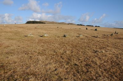
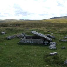
Fernacre, Bronze Age stone circle in Cornwall, United Kingdom
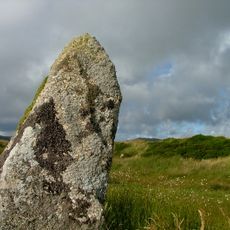
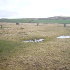
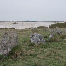
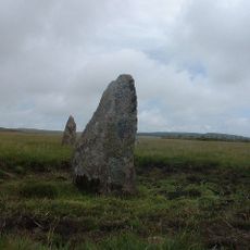
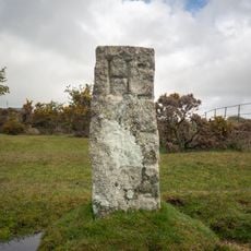
Fernacre is a stone circle comprising between 52 and 70 standing stones arranged in a circular pattern on the Cornish landscape near Hallworthy. The stones are positioned to form a clear ring, with individual blocks varying in size and appearing naturally distributed across the site.
The stone circle was built around 2000 BC during the Bronze Age, a time when numerous prehistoric monuments were being constructed across Cornwall. This period demonstrates that local communities had the resources and organization to create such structures.
This circle served as a gathering place for Bronze Age communities during important ceremonies and social occasions. The site reflects how early people came together and organized themselves around sacred spaces.
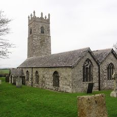
The site sits on private land, so visitors should obtain permission beforehand and stick to marked paths. Best visited during daylight hours with sturdy footwear, as the ground can be uneven and occasionally muddy.
Three neighboring stone circles in the area, including this one, Louden Hill, and Stannon, each feature a large triangular stone despite bigger boulders being available nearby. This unusual choice suggests the builders made a deliberate symbolic or functional decision.
GPS coordinates: 50.59000,-4.62237
Latest update: December 12, 2025 17:44
Jamaica Inn
5 km
RAF Davidstow Moor
5.1 km
King Arthur's Hall
2.8 km
Trippet stones
5.2 km
Stannon stone circle
2 km
Stripple stones
4.8 km
Crowdy Reservoir
3.6 km
Emblance Downs stone circles
2.7 km
Church of St Adwen
4.3 km
Holy Trinity Church
4.9 km
Six cairns on Buttern Hill
3.4 km
Milestone 40 Metres To The South Of Holy Trinity Church
5 km
Boundary Stone To South West Of Delford Bridge
5.1 km
Guidepost At Junction Of A39T And B3266
5.2 km
Milestone 40 Metres To North East Of Worthy Acre Cottage
5.1 km
The Middle Moor Cross, 230m north-east of Camperdown Farm
2.1 km
Delford Bridge
5.1 km
Bolventor War Memorial and dwarf walls
5 km
Bowithick Bridge and footbridge
4.7 km
White Meadow
3.6 km
Farmbuildings Including Granary, Barn And Shippons 20 Metres To North West Of Trewint Farmhouse
4.1 km
Clapperbridge To East Of Ivey
3.7 km
Borough Boundary Stone To North 24 Roughtor Road
5 km
Trewint
4.1 km
Borough Boundary Stone 30 Metres To North East Of Sewage Works
5.1 km
Trethin
4.5 km
Foot bridge 900 metres to south east of Roughtor Farm
2 km
Footbridge To South East Of Bothwick
4.7 kmVisited this place? Tap the stars to rate it and share your experience / photos with the community! Try now! You can cancel it anytime.
Discover hidden gems everywhere you go!
From secret cafés to breathtaking viewpoints, skip the crowded tourist spots and find places that match your style. Our app makes it easy with voice search, smart filtering, route optimization, and insider tips from travelers worldwide. Download now for the complete mobile experience.
A unique approach to discovering new places❞
— Le Figaro
All the places worth exploring❞
— France Info
A tailor-made excursion in just a few clicks❞
— 20 Minutes