Chest opened
+${chestReward.xp} XP
Explorer
NOUVEAU ×${chestReward.collectible.quantity}
tapez pour fermer
Chest locked

Open chests in the app

Around Us is built for your phone — chests unlock when you walk, explore and capture nearby places.

Enable Location

We need your location to show you interesting places around you

Discover nearby places

Find interesting locations and hidden gems around you

Precise directions

Get accurate directions and distances to places

Your location is never shared with other users. It's only used when you tap the location button.

Log in to your account

Start exploring — it's free

Trusted by 72,930 travelers worldwide

Continue with Google
Continue with Apple
or

We will send you a code to connect

By continuing, you accept our Terms and Conditions and our Privacy Policy

Check your inbox

We've sent a pincode in your inbox. Please enter the code below.

Giant's Hole
Discussion Reviews Photo
3.3k Popularity

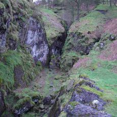
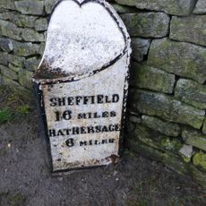
Giant's Hole, Natural cave system in Castleton, United Kingdom.

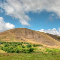
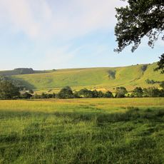
Giant's Hole is a limestone cave system in Castleton featuring large passages and an active underground stream flowing through the darkness. The network extends several kilometers beneath the surface, with different chambers and passages at varying depths.

The cave was documented during early explorations of the Peak District in the 1800s and became important for geological research in the region. It contributed to understanding how limestone landscapes form and change underground.

Giant's Hole serves as a primary training ground for cave rescue organizations, contributing to the development of underground safety protocols in British caving.

You will need to walk into the cave and adjust to wet, slippery conditions underfoot throughout your visit. Bring sturdy shoes with good grip and a flashlight or headlamp to move safely through the passages.

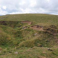
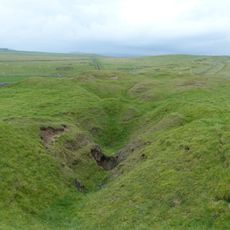
It connects underground to nearby Oxlow Cavern, creating a larger network of passages that extends to considerable depths below the ground. This underground link makes the area popular with advanced explorers and rescue training teams.

The community of curious travelers

AroundUs brings together thousands of curated places, local tips, and hidden gems, enriched daily by 60,000 contributors worldwide.

Start exploring
Location
GPS coordinates
53.34090,-1.82211
Latest update
December 12, 2025 09:00
Around this place
Mam Tor
United Kingdom

Mam Tor

1.2 km
Blue John Cavern
United Kingdom

Blue John Cavern

1.3 km
Titan
United Kingdom

Titan

2.1 km
Speedwell Cavern
United Kingdom

Speedwell Cavern

2 km
Treak Cliff Cavern
United Kingdom

Treak Cliff Cavern

1.7 km
Peak District National Park
United Kingdom

Peak District National Park

1.3 km
Odin Mine nucleated lead mine and ore works, 350m WNW of Knowlegates Farm
United Kingdom

Odin Mine nucleated lead mine and ore works, 350m WNW of Knowlegates Farm

1.7 km
Methodist Chapel
United Kingdom

Methodist Chapel

2.2 km
Mam Tor hillfort
United Kingdom

Mam Tor hillfort

1.3 km
Milepost At Os 127 832
United Kingdom

Milepost At Os 127 832

816 m
Ivy House
United Kingdom

Ivy House

2.2 km
Milepost 800 yards to the south of Peakshill Farmhouse
United Kingdom

Milepost 800 yards to the south of Peakshill Farmhouse

902 m
Barn opposite Methodist Chapel
United Kingdom

Barn opposite Methodist Chapel

2.2 km
Dalehead Farmhouse and attached barn
United Kingdom

Dalehead Farmhouse and attached barn

2.4 km
Milepost at OS 134 837
United Kingdom

Milepost at OS 134 837

1.8 km
Milepost 20 yards to the north east of Perryfoot Farmhouse
United Kingdom

Milepost 20 yards to the north east of Perryfoot Farmhouse

2.3 km
Rushup Hall
United Kingdom

Rushup Hall

2.5 km
Faucet Rake lead mines 870m south west and 930m south east of Oxlow House
United Kingdom

Faucet Rake lead mines 870m south west and 930m south east of Oxlow House

843 m
Hollins Farmhouse and attached barn
United Kingdom

Hollins Farmhouse and attached barn

2.5 km
Eldon Hill crushing circle, associated lead mining remains and palisaded enclosure on Eldon Hill
United Kingdom

Eldon Hill crushing circle, associated lead mining remains and palisaded enclosure on Eldon Hill

1.6 km
Watt's Grove Rake lead mines 520m north of Sweetknoll
United Kingdom

Watt's Grove Rake lead mines 520m north of Sweetknoll

2 km
Eldon Hill bowl barrow
United Kingdom

Eldon Hill bowl barrow

1.6 km
Perry Dale bowl barrow and long barrow
United Kingdom

Perry Dale bowl barrow and long barrow

1.8 km
Ox Low oval barrow
United Kingdom

Ox Low oval barrow

2.4 km
Oxlow Rake lead mines
United Kingdom

Oxlow Rake lead mines

2.5 km
Small Clough Farmhouse and attached barn
United Kingdom

Small Clough Farmhouse and attached barn

2.1 km
Milepost at OS 146 828
United Kingdom

Milepost at OS 146 828

2.6 km
Milepost 230 Metres From Rushop Lane Junction
United Kingdom

Milepost 230 Metres From Rushop Lane Junction

2.5 km
Show the full map
Reviews
Share your experience

No review yet

Discussions
Start a discussion...

No discussion yet

« Giant's Hole - Natural cave system in Castleton, United Kingdom » is provided by Around Us (aroundus.com). Images and texts are derived from Wikimedia project under a Creative Commons license. You are allowed to copy, distribute, and modify copies of this page, under the conditions set by the license, as long as this note is clearly visible.

Discover hidden gems everywhere you go!

From secret cafés to breathtaking viewpoints, skip the crowded tourist spots and find places that match your style. Our app makes it easy with voice search, smart filtering, route optimization, and insider tips from travelers worldwide. Download now for the complete mobile experience.

Around Us App Screenshot

A unique approach to discovering new places

Le Figaro

All the places worth exploring

France Info

A tailor-made excursion in just a few clicks

20 Minutes

Around Us
Travel Guide & Maps
Download

Send to your phone

QR Code
1

Open the camera app on your mobile.

2

Point at the QR code with your camera. A notification will appear.

3

Tap the notification to open the link.