Enable Location

We need your location to show you interesting places around you

Discover nearby places

Find interesting locations and hidden gems around you

Precise directions

Get accurate directions and distances to places

Your location is never shared with other users. It's only used when you tap the location button.

Gurnard's Head

Log in to your account

Start exploring — it's free

Trusted by 61,563 travelers worldwide

Continue with Google
Continue with Apple
or

We will send you a code to connect

By continuing, you accept our Terms and Conditions and our Privacy Policy

Check your inbox

We've sent a pincode in your inbox. Please enter the code below.

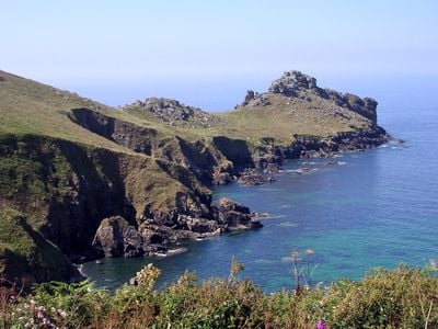
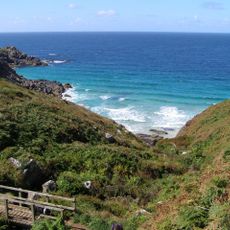
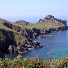
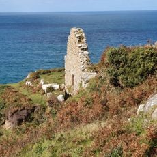
Gurnard's Head, Iron Age promontory fort in Zennor, England

Description

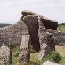
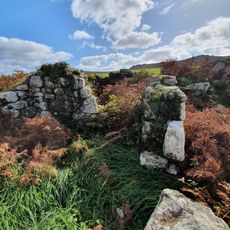
Gurnard's Head is an Iron Age promontory fort on the north coast of the Penwith peninsula, jutting into the Atlantic Ocean. Two stone ramparts cross its narrowest section, marking the outer and inner boundaries of this ancient fortification.

History

The site was built during the Iron Age to defend this exposed coastal location. Excavations in 1939 revealed that the inner rampart had three steps, creating defensive positions for slingers who protected the settlement.

Culture

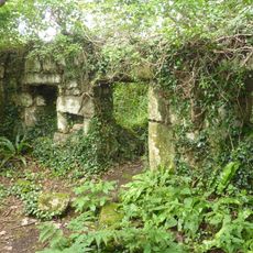
The Cornish name Ynyal reflects the isolated character of this coastal fortification where people once lived together. Sixteen round houses once stood here, revealing how Iron Age inhabitants organized their settlement on this exposed headland.

Practical

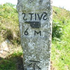
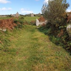
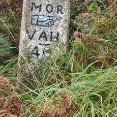
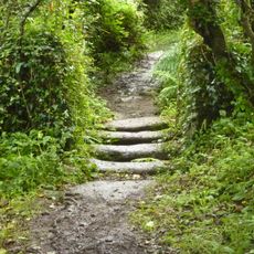
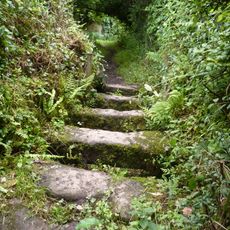
The site sits along the South West Coast Path and is easily reached via this popular walking route that crosses the southern part of the headland. The National Trust maintains this scheduled monument and keeps the ramparts and house remains in accessible condition.

Did you know?

The headland contains basaltic pillow lavas formed by underwater volcanic eruptions hundreds of millions of years ago. This ancient rock formation beneath the Iron Age fortification reveals how nature's forces shaped the landscape long before people built here.

Location
GPS coordinates
50.19161,-5.59922
Latest update
December 11, 2025 18:11

AroundUs brings together thousands of curated places, local tips, and hidden gems, enriched daily by 60,000 contributors worldwide. Discover all places nearby (Zennor).

« Gurnard's Head - Iron Age promontory fort in Zennor, England » is provided by Around Us (aroundus.com). Images and texts are derived from Wikimedia project under a Creative Commons license. You are allowed to copy, distribute, and modify copies of this page, under the conditions set by the license, as long as this note is clearly visible.

Discover hidden gems everywhere you go!

From secret cafés to breathtaking viewpoints, skip the crowded tourist spots and find places that match your style. Our app makes it easy with voice search, smart filtering, route optimization, and insider tips from travelers worldwide. Download now for the complete mobile experience.

Around Us App Screenshot

A unique approach to discovering new places

Le Figaro

All the places worth exploring

France Info

A tailor-made excursion in just a few clicks

20 Minutes

Around Us
Travel Guide & Maps
Download

Send to your phone

QR Code
1

Open the camera app on your mobile.

2

Point at the QR code with your camera. A notification will appear.

3

Tap the notification to open the link.