Chest opened
+${chestReward.xp} XP
Explorer
NOUVEAU ×${chestReward.collectible.quantity}
tapez pour fermer
Chest locked

Open chests in the app

Around Us is built for your phone — chests unlock when you walk, explore and capture nearby places.

Enable Location

We need your location to show you interesting places around you

Discover nearby places

Find interesting locations and hidden gems around you

Precise directions

Get accurate directions and distances to places

Your location is never shared with other users. It's only used when you tap the location button.

Log in to your account

Start exploring — it's free

Trusted by 72,957 travelers worldwide

Continue with Google
Continue with Apple
or

We will send you a code to connect

By continuing, you accept our Terms and Conditions and our Privacy Policy

Check your inbox

We've sent a pincode in your inbox. Please enter the code below.

Gurney Slade quarry
Discussion Reviews Photo
1.6k Popularity

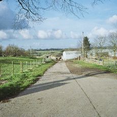
Gurney Slade quarry, Limestone quarry in Somerset, England.

Gurney Slade quarry in Somerset displays pale to dark grey Carboniferous Limestone beneath overlying Triassic breccias and marls across its extensive grounds. The exposed rock layers reveal the geological history of the region.

Extraction began in the mid-18th century, and Francis Flower and Sons took over in 1928 for lime-burning operations. The site later developed into modern commercial production.

The quarry gave its name to a British television series from 1960 and remains tied to the industrial heritage of the Mendip Hills region. This connection links the site to mid-century British popular culture.

The site is operated by Morris and Perry Ltd and produces aggregates, asphalt, ready-mixed concrete, and agricultural lime. Visitors should arrange access in advance as this is an active working facility.

The quarry contains striking vertical sediment-filled fissures known as Neptunian Dykes formed by natural geological processes. An angular unconformity between Carboniferous Limestone and Lower Jurassic rock layers is also visible on site.

The community of curious travelers

AroundUs brings together thousands of curated places, local tips, and hidden gems, enriched daily by 60,000 contributors worldwide.

Start exploring
GPS coordinates
51.24520,-2.53719
Latest update
December 14, 2025 14:26
Around this place
Downside Abbey
United Kingdom

Downside Abbey

3.2 km
Maesbury Castle
United Kingdom

Maesbury Castle

3 km
Harridge Wood
United Kingdom

Harridge Wood

2.9 km
Church of St James, Ashwick
United Kingdom

Church of St James, Ashwick

1.7 km
Ashwick Court
United Kingdom

Ashwick Court

1.6 km
Church of St Vigor, Stratton-on-the-Fosse
United Kingdom

Church of St Vigor, Stratton-on-the-Fosse

3.5 km
Church of the Blessed Virgin Mary, Emborough
United Kingdom

Church of the Blessed Virgin Mary, Emborough

2 km
Church of the Holy Trinity
United Kingdom

Church of the Holy Trinity

1.1 km
Church of St Mary the Virgin, Ston Easton
United Kingdom

Church of St Mary the Virgin, Ston Easton

3.8 km
Former Christ Church
United Kingdom

Former Christ Church

1.7 km
Church of St John the Baptist
United Kingdom

Church of St John the Baptist

3.4 km
Abbey Church of St Gregory the Great, Downside Abbey
United Kingdom

Abbey Church of St Gregory the Great, Downside Abbey

3.1 km
The King's Arms
United Kingdom

The King's Arms

3.3 km
Milepost At Ngr St 6545 4995 On Roadside
United Kingdom

Milepost At Ngr St 6545 4995 On Roadside

2.8 km
Chilcompton War Memorial
United Kingdom

Chilcompton War Memorial

2.9 km
Dower Cottage  Dower House  Dower House Cottage
United Kingdom

Dower Cottage Dower House Dower House Cottage

4 km
Milepost At Ngr St 6484 4869 On Roadside
United Kingdom

Milepost At Ngr St 6484 4869 On Roadside

2.5 km
Milepost At Ngr St 6300 4654
United Kingdom

Milepost At Ngr St 6300 4654

3.2 km
Church St Benedict (Roman Catholic)
United Kingdom

Church St Benedict (Roman Catholic)

3.4 km
Milepost At Ngr St6222 4787
United Kingdom

Milepost At Ngr St6222 4787

1.9 km
Whitchurch Farmhouse
United Kingdom

Whitchurch Farmhouse

3.9 km
Milepost On A37 At Ngr St 6238 5242
United Kingdom

Milepost On A37 At Ngr St 6238 5242

2.7 km
Oakhill Methodist Church And Adjacent Gate Piers And Gate Of Forecourt Walls
United Kingdom

Oakhill Methodist Church And Adjacent Gate Piers And Gate Of Forecourt Walls

2.5 km
Boundary Stone At St6389946560
United Kingdom

Boundary Stone At St6389946560

3.4 km
5, High Street
United Kingdom

5, High Street

4.2 km
Milepost On B3139 At Ngr St 6063 5046
United Kingdom

Milepost On B3139 At Ngr St 6063 5046

2.1 km
Milepost At Ngr St 6608 5143 On Roadside
United Kingdom

Milepost At Ngr St 6608 5143 On Roadside

3.9 km
Milestone, near radio mast and Warren Farm
United Kingdom

Milestone, near radio mast and Warren Farm

3.1 km
Show the full map
Reviews
Share your experience

No review yet

Discussions
Start a discussion...

No discussion yet

« Gurney Slade quarry - Limestone quarry in Somerset, England » is provided by Around Us (aroundus.com). Images and texts are derived from Wikimedia project under a Creative Commons license. You are allowed to copy, distribute, and modify copies of this page, under the conditions set by the license, as long as this note is clearly visible.

Discover hidden gems everywhere you go!

From secret cafés to breathtaking viewpoints, skip the crowded tourist spots and find places that match your style. Our app makes it easy with voice search, smart filtering, route optimization, and insider tips from travelers worldwide. Download now for the complete mobile experience.

Around Us App Screenshot

A unique approach to discovering new places

Le Figaro

All the places worth exploring

France Info

A tailor-made excursion in just a few clicks

20 Minutes

Around Us
Travel Guide & Maps
Download

Send to your phone

QR Code
1

Open the camera app on your mobile.

2

Point at the QR code with your camera. A notification will appear.

3

Tap the notification to open the link.