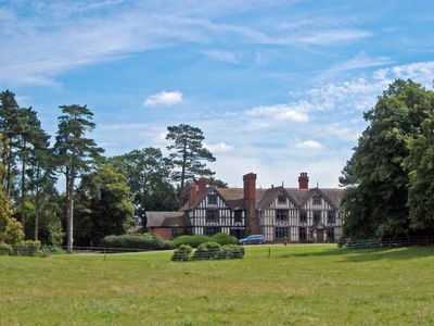
Highfields, Grade I listed English country house in Buerton, Cheshire East, UK
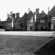
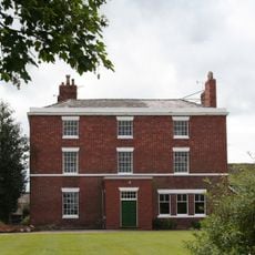
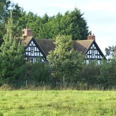
Highfields is a timber-framed country house in Buerton, England, with two stories, an attic, and five evenly spaced sections across its front. The house features gabled wings projecting from both sides and sits on a stone base that protects the wooden frame from ground moisture.
The house was built in 1615 for William Dod and later modified in 1750 and 1897 by architects. The Baker family has owned it since 1736 and maintained its historical appearance across generations.
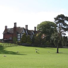
The name Highfields refers to the open fields surrounding the rural area of Buerton. The wooden structure shows how people built homes to withstand centuries of country life and weather.
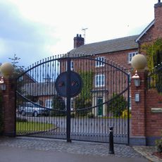
The house sits in a quiet rural area of Buerton and is best viewed on foot to observe details of the timber facade and projecting gables. Access is via small country lanes that preserve the rural character of the location.
The timber walls use close-studded framing where wooden posts are placed closely together, a technique from the early 1600s that required great skill. This labor-intensive method reflects the high craftsmanship standards of that era.
The community of curious travelers
AroundUs brings together thousands of curated places, local tips, and hidden gems, enriched daily by 60,000 contributors worldwide.