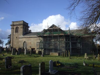
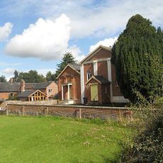
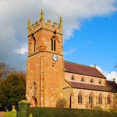
St Peter's Church, Adderley, Anglican church in Adderley, England.
St Peter's Church in Adderley is an English Gothic church constructed from yellow-grey sandstone with slate roofing that displays a cruciform layout with a three-bay nave and single-bay chancel flanked by two transepts. The interior features cast iron windows produced in the nearby Coalbrookdale industrial area.
The north transept was built between 1635 and 1636 as a burial chapel for the Needham family during the 17th century. The tower was added later in 1712 and became a defining feature of the building's exterior.
The church serves as an active parish space where the nave welcomes worshippers and visitors, while the chancel is separately cared for by a conservation organization. Walking through, you notice how the building still functions for community gatherings despite its split management.
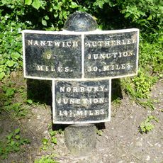
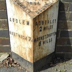
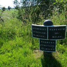
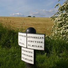
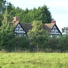
The church sits off the main A529 road between Market Drayton and Audlem, so look carefully for the turning if arriving by car. Plan to spend time inside exploring the interior details and ironwork, as there is much to examine at leisure.
Inside you will find a Norman-style font carved with medieval Latin inscriptions that often goes unnoticed by casual visitors. An ornate wooden screen from 1637 displays the heraldic symbols of the Needham family and represents a remarkable example of skilled craftsmanship from that era.
Location: Adderley
Inception: 1635
Architectural style: English Gothic architecture
Website: http://visitchurches.org.uk/findachurch/st-peter-adderley/?region=Shropshire
GPS coordinates: 52.95220,-2.50590
Latest update: December 14, 2025 18:10
Styche Hall
4.2 km
St James' Church, Audlem
4.1 km
Moss Hall
4.6 km
Adderley Hall
954 m
Oakley Hall
4.8 km
Highfields
2 km
Audlem Baptist Church
4.1 km
Church of Saint Chad
4.3 km
Bridge No 75 at SJ 659 415
2 km
Bridge No 74 at SJ 660 411
1.6 km
Memorial Lampstandard
4.1 km
The Old Grammar School
4.1 km
Market Drayton Memorial Cross
5.3 km
Milepost on E. side of Audlem Lock No. 5, at SJ 659 423
2.8 km
The Market House
4.1 km
Milepost Approximately 35 Metres To North Of Bridge Number 70
882 m
Milepost Approximately 1040 Metres To South Of Bridge Number 66
3.4 km
Milepost Shropshire Union Canal
3.9 km
The Devil's Ring and Finger
4.9 km
Milepost Approximately 170 Metres To South Of Bridge Number 67
1.9 km
Milepost Approximately 550 Metres To North West Of Bridge Number 73
1.4 km
Butterley Heyes
2.7 km
Milepost, Corbrook
5.4 km
Milepost, W of A525, canal bridge
4 km
Milepost, Bridge Farm
2.6 km
Milepost, between Bruerton Hall and Bruerton village
4.3 km
Milepost, between Oldmill Bridge and Weaver Bank Farm
3.9 km
Milepost, W of entrance to The Grange
5.1 kmVisited this place? Tap the stars to rate it and share your experience / photos with the community! Try now! You can cancel it anytime.
Discover hidden gems everywhere you go!
From secret cafés to breathtaking viewpoints, skip the crowded tourist spots and find places that match your style. Our app makes it easy with voice search, smart filtering, route optimization, and insider tips from travelers worldwide. Download now for the complete mobile experience.
A unique approach to discovering new places❞
— Le Figaro
All the places worth exploring❞
— France Info
A tailor-made excursion in just a few clicks❞
— 20 Minutes