Jay's Grave

Log in to your account

AroundUs is a community-driven map of interesting places, built by curious explorers like you. It grows with every review, story, and photo you share.
Connect to save your favorite spots, contribute locations, and create personalized routes.
Continue with Google
Continue with Apple
Continue with X
Continue with Facebook
Continue with email
By continuing, you accept our Terms and Conditions and our Privacy Policy
Create an account
Add to collection
Map
Suggest a change
Share

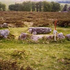
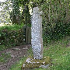
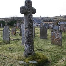
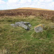
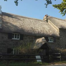
Jay's Grave, Archaeological burial site near Manaton, Devon, England

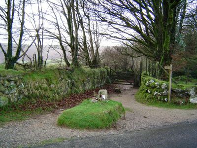
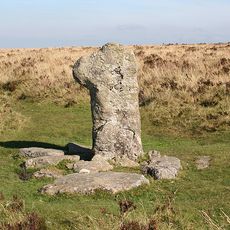
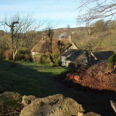
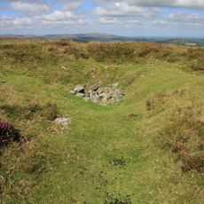
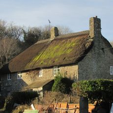
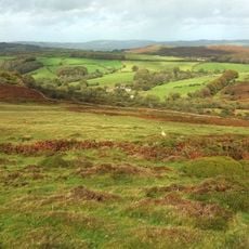
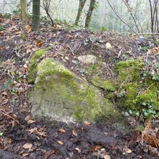
Jay's Grave is a burial site at a crossroads near Hound Tor in Dartmoor National Park. A simple headstone marks the spot, surrounded by heathland and open moorland.

In the 1850s, remains of a young woman who lived in the 18th century were discovered here. She was identified as Mary Jay, and the site later became a known memorial on the moor.

The name recalls a farm servant who lived and worked near Manaton, and her story continues to be told across the moor today. Walkers and visitors still leave fresh flowers on the grave, so the site never feels abandoned.

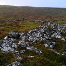
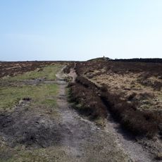
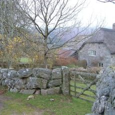
Access is via small footpaths that cross walking routes through Dartmoor, and the nearest parking is along the road west of Hound Tor. In rain or fog, the ground becomes slippery, so sturdy footwear is recommended.

No one knows who places fresh flowers on the grave every day, and so far no local or visitor has claimed responsibility. The flowers appear in every season, even in winter or bad weather.

Location: Manaton

GPS coordinates: 50.60510,-3.79269

Latest update: December 20, 2025 15:18

Photos
Around this place
Becky Falls
United Kingdom

Becky Falls

2.9 km
Church of Saint Pancras, Widecombe-in-the-Moor
United Kingdom

Church of Saint Pancras, Widecombe-in-the-Moor

3.4 km
Ring cairn south west of Hound Tor, 215m east of East Lodge
United Kingdom

Ring cairn south west of Hound Tor, 215m east of East Lodge

1.4 km
Church of St Winifrid
United Kingdom

Church of St Winifrid

2.2 km
The Old Inn
United Kingdom

The Old Inn

3.4 km
Clapper Bridge On The Road From Widecombe Village To Natsworthy, About 130 Metres North East Of Wooder Manor
United Kingdom

Clapper Bridge On The Road From Widecombe Village To Natsworthy, About 130 Metres North East Of Wooder Manor

2.4 km
Foxworthy Mill House And Mill
United Kingdom

Foxworthy Mill House And Mill

3.3 km
Beckaford Bridge
United Kingdom

Beckaford Bridge

2.4 km
Hound Tor Deserted Medieval Village
United Kingdom

Hound Tor Deserted Medieval Village

1.8 km
Manaton War Memorial
United Kingdom

Manaton War Memorial

2.2 km
Churchyard Cross Approximately 17 Metres South West Of Church Of St. Winifrid
United Kingdom

Churchyard Cross Approximately 17 Metres South West Of Church Of St. Winifrid

2.1 km
Cross About 5 Metres South Of South Transept Of St Pancras Church
United Kingdom

Cross About 5 Metres South Of South Transept Of St Pancras Church

3.4 km
Grimspound, a partially enclosed prehistoric settlement with field system and two post-medieval caches between Hookney Tor and H
United Kingdom

Grimspound, a partially enclosed prehistoric settlement with field system and two post-medieval caches between Hookney Tor and H

3.3 km
Hameldown Beacon barrow
United Kingdom

Hameldown Beacon barrow

2.6 km
Half Moon House
United Kingdom

Half Moon House

2.2 km
Middle Bonehill Farmhouse, Including Garden Wall In Front Of Right Hand Side Of House
United Kingdom

Middle Bonehill Farmhouse, Including Garden Wall In Front Of Right Hand Side Of House

2.5 km
Cairn and cist 430m north east of Grimspound
United Kingdom

Cairn and cist 430m north east of Grimspound

3.1 km
Linhay About 5 Metres South-West Of Barn At Foxworthy Farm
United Kingdom

Linhay About 5 Metres South-West Of Barn At Foxworthy Farm

3.4 km
Hamel Down Cross
United Kingdom

Hamel Down Cross

2.8 km
Swallerton Gate
United Kingdom

Swallerton Gate

1 km
Mill Farmhouse
United Kingdom

Mill Farmhouse

2 km
Lower Hookney Farmhouse
United Kingdom

Lower Hookney Farmhouse

3.1 km
King's Barrow on King Tor, Hookney Down
United Kingdom

King's Barrow on King Tor, Hookney Down

2.8 km
Southcott Farmhouse
United Kingdom

Southcott Farmhouse

1.8 km
Hedge Barton Farmhouse
United Kingdom

Hedge Barton Farmhouse

950 m
Barn About 10 Metres South-West Of Foxworthy Farmhouse
United Kingdom

Barn About 10 Metres South-West Of Foxworthy Farmhouse

3.4 km
Milestone, 25m N of Stouts
United Kingdom

Milestone, 25m N of Stouts

2.2 km
Bowerman's Nose
United Kingdom

Bowerman's Nose

1.1 km
Show the full map
Reviews

Visited this place? Tap the stars to rate it and share your experience / photos with the community! Try now! You can cancel it anytime.

« Jay's Grave - Archaeological burial site near Manaton, Devon, England » is provided by Around Us (aroundus.com). Images and texts are derived from Wikimedia project under a Creative Commons license. You are allowed to copy, distribute, and modify copies of this page, under the conditions set by the license, as long as this note is clearly visible.

Discover hidden gems everywhere you go!

From secret cafés to breathtaking viewpoints, skip the crowded tourist spots and find places that match your style. Our app makes it easy with voice search, smart filtering, route optimization, and insider tips from travelers worldwide. Download now for the complete mobile experience.

Around Us App Screenshot

A unique approach to discovering new places

Le Figaro

All the places worth exploring

France Info

A tailor-made excursion in just a few clicks

20 Minutes