Jesmond Dene

Log in to your account

AroundUs is a community-driven map of interesting places, built by curious explorers like you. It grows with every review, story, and photo you share.
Connect to save your favorite spots, contribute locations, and create personalized routes.
Continue with Google
Continue with Apple
Continue with X
Continue with Facebook
Continue with email
By continuing, you accept our Terms and Conditions and our Privacy Policy
Create an account
Add to collection
Map
Suggest a change
Share

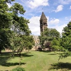
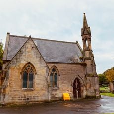
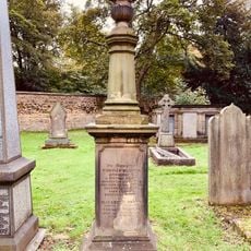
Jesmond Dene, Public garden and valley in Newcastle upon Tyne, England

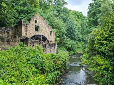
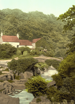
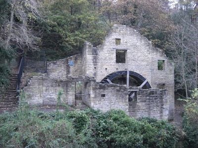
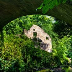
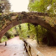
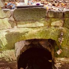
Jesmond Dene is a 3 km wooded valley in Newcastle where the Ouseburn River winds through natural terrain with mature trees on both sides. Connected walkways and bridges allow visitors to explore from one end to the other through different sections.

William Armstrong purchased the land in 1862 and developed it with waterfalls and exotic plantings before donating it to Newcastle in 1883. This gift established a new model for public green space in the industrial city.

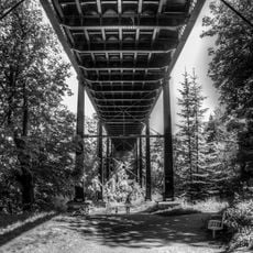
The Armstrong Bridge serves as a gathering place where locals and visitors naturally meet during market days and regular visits. This spot has become part of how people experience and share the valley with one another.

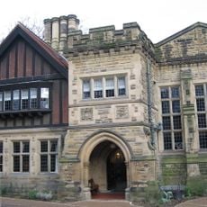
A Visitor Centre, Pets Corner, and two cafes provide basic facilities for a comfortable visit. Parking is available along Red Walk, making it easy to access the park from different points.

Recordings of bird songs from early mornings in this valley are used in hospitals and workplaces to support people during recovery and rest. This unexpected connection between nature and healing sets the place apart.

Location: Newcastle upon Tyne

Address: Newcastle upon Tyne NE7 7DZ, UK

Website: https://urbangreennewcastle.org/our-green-spaces/parks/jesmond-dene

GPS coordinates: 54.99000,-1.59000

Latest update: December 6, 2025 16:04

Photos
Newcastle upon Tyne: cultural visits, stadiums, and monuments in northern England

Newcastle upon Tyne and its neighbor Gateshead form a lively urban area in the northeast of England, where industrial history meets contemporary creation. The city retains traces of its medieval past with Castle Keep, a 12th-century fortress, while Grey's Monument reflects 19th-century political...

Around this place
Jesmond Dene House
United Kingdom

Jesmond Dene House

1.3 km
People's Theatre
United Kingdom

People's Theatre

335 m
Jesmond Old Cemetery
United Kingdom

Jesmond Old Cemetery

930 m
Banqueting House With Added Gatehouse And Other Extensions
United Kingdom

Banqueting House With Added Gatehouse And Other Extensions

420 m
Jesmond Synagogue
United Kingdom

Jesmond Synagogue

1.2 km
Holy Name parish, Jesmond
United Kingdom

Holy Name parish, Jesmond

1.3 km
Jesmond Library
United Kingdom

Jesmond Library

1.1 km
Church of St George
United Kingdom

Church of St George

992 m
Jesmond Church Of St Hilda
United Kingdom

Jesmond Church Of St Hilda

1.2 km
Church of the Holy Trinity
United Kingdom

Church of the Holy Trinity

282 m
Church of St Gabriel and Hall Attached
United Kingdom

Church of St Gabriel and Hall Attached

504 m
Akhurst School (Jesmond Cottage) And Gas Lamp At Door
United Kingdom

Akhurst School (Jesmond Cottage) And Gas Lamp At Door

700 m
Fairless Harrison Tomb About 100 Metres East Of Jesmond Cemetery Gateway
United Kingdom

Fairless Harrison Tomb About 100 Metres East Of Jesmond Cemetery Gateway

817 m
All Saints' Cemetery Mortuary Chapels
United Kingdom

All Saints' Cemetery Mortuary Chapels

769 m
Sunday School Attached To Church Of St Hilda
United Kingdom

Sunday School Attached To Church Of St Hilda

1.2 km
St Mary's Chapel, Jesmond
United Kingdom

St Mary's Chapel, Jesmond

492 m
Armstrong Bridge
United Kingdom

Armstrong Bridge

87 m
The Former Phillipson Memorial Orphanage At Princess Mary Maternity Hospital
United Kingdom

The Former Phillipson Memorial Orphanage At Princess Mary Maternity Hospital

1.4 km
Town Moor Boundary Stone Opposite Number 73
United Kingdom

Town Moor Boundary Stone Opposite Number 73

1.6 km
Tomb Of Thomas Oliver In Jesmond Cemetery About 140 Metres North East Of Gateway
United Kingdom

Tomb Of Thomas Oliver In Jesmond Cemetery About 140 Metres North East Of Gateway

777 m
Jesmond Dene Mill
United Kingdom

Jesmond Dene Mill

1.2 km
Pillar Box North Of Number 4
United Kingdom

Pillar Box North Of Number 4

915 m
Footbridge North East Of Banqueting Hall
United Kingdom

Footbridge North East Of Banqueting Hall

461 m
St Mary's Well
United Kingdom

St Mary's Well

546 m
High Heaton Library
United Kingdom

High Heaton Library

686 m
Jesmond United Reformed Church
United Kingdom

Jesmond United Reformed Church

1.3 km
Boundary Mark In Wall At Junction With South Side Of Moorfield
United Kingdom

Boundary Mark In Wall At Junction With South Side Of Moorfield

1.6 km
All Saints' Cemetery Gate, Walls, Piers, Gates And Railings
United Kingdom

All Saints' Cemetery Gate, Walls, Piers, Gates And Railings

763 m
Show the full map
Reviews

Visited this place? Tap the stars to rate it and share your experience / photos with the community! Try now! You can cancel it anytime.

« Jesmond Dene - Public garden and valley in Newcastle upon Tyne, England » is provided by Around Us (aroundus.com). Images and texts are derived from Wikimedia project under a Creative Commons license. You are allowed to copy, distribute, and modify copies of this page, under the conditions set by the license, as long as this note is clearly visible.

Discover hidden gems everywhere you go!

From secret cafés to breathtaking viewpoints, skip the crowded tourist spots and find places that match your style. Our app makes it easy with voice search, smart filtering, route optimization, and insider tips from travelers worldwide. Download now for the complete mobile experience.

Around Us App Screenshot

A unique approach to discovering new places

Le Figaro

All the places worth exploring

France Info

A tailor-made excursion in just a few clicks

20 Minutes