Hoarstones

Log in to your account

AroundUs is a community-driven map of interesting places, built by curious explorers like you. It grows with every review, story, and photo you share.
Connect to save your favorite spots, contribute locations, and create personalized routes.
Continue with Google
Continue with Apple
Continue with X
Continue with Facebook
Continue with email
By continuing, you accept our Terms and Conditions and our Privacy Policy
Create an account
Add to collection
Map
Suggest a change
Share

Hoarstones, Stone circle in Chirbury with Brompton, England

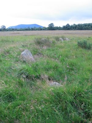
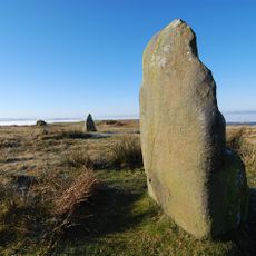
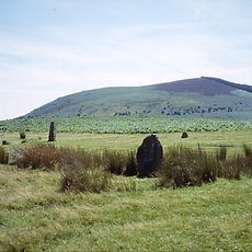
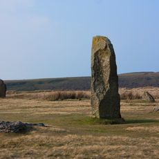
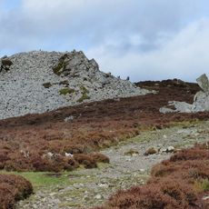
The Hoarstones form a stone circle on the moorland of Shropshire with an elliptical shape measuring roughly 23 by 21 meters across. The ring consists of 38 to 40 small dolerite stones arranged in a deliberate pattern.

This stone circle originated during the transition from Neolithic to Bronze Age around 3000 BCE, when building practices shifted from long earthen mounds to round monuments. Researchers first documented the site in the 1830s, and an excavation in the 1920s uncovered more details about how it was constructed.

The stone circle represents Late Neolithic to Early Bronze Age construction practices, marking a shift from long barrows to circular monuments around 3000 BCE.

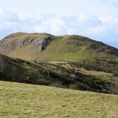
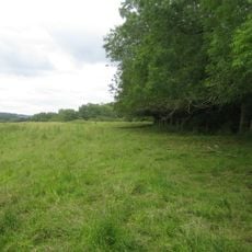
The site sits on elevated moorland at roughly 300 meters in height and lies approximately 11 kilometers north of Bishop's Castle. Visitors should check local access permissions before going, as the land is privately owned and entry may be restricted.

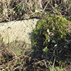
Some of the stones bear small drill holes made by 19th-century miners who would fill them with gunpowder and detonate them as celebrations during local weddings. These marks tell the story of how the ancient site became part of community festivities in more recent times.

GPS coordinates: 52.59280,-2.99917

Latest update: December 12, 2025 14:23

Photos
Around this place
Mitchell's Fold
United Kingdom

Mitchell's Fold

2.4 km
Corndon Hill
United Kingdom

Corndon Hill

3.5 km
Roundton Hill
United Kingdom

Roundton Hill

5.8 km
Church of All Saints
United Kingdom

Church of All Saints

4.8 km
Church of Holy Trinity
United Kingdom

Church of Holy Trinity

2.3 km
Church of St Michael
United Kingdom

Church of St Michael

6.4 km
Church of Holy Trinity
United Kingdom

Church of Holy Trinity

2.7 km
Church of St Mark
United Kingdom

Church of St Mark

4.4 km
Church of All Saints
United Kingdom

Church of All Saints

1.5 km
St Etheldreda
United Kingdom

St Etheldreda

5.4 km
Gunley Hall
United Kingdom

Gunley Hall

6.4 km
The Cock Inn
United Kingdom

The Cock Inn

4.6 km
Chirbury War Memorial
United Kingdom

Chirbury War Memorial

6.4 km
Milestone At Ngr Sj 3396 0102
United Kingdom

Milestone At Ngr Sj 3396 0102

1.9 km
The Old White Horse
United Kingdom

The Old White Horse

4.8 km
Milestone Approximately 135 Metres To North Of Brook Field
United Kingdom

Milestone Approximately 135 Metres To North Of Brook Field

4.5 km
Milestone At Ngr So 3246 9695
United Kingdom

Milestone At Ngr So 3246 9695

3 km
Worthen Hall Farmhouse
United Kingdom

Worthen Hall Farmhouse

4.9 km
Milestone At Ngr So 3214 9845
United Kingdom

Milestone At Ngr So 3214 9845

1.5 km
Group Of 10 Chest Tombs Approximately 3.5 To 10 Metres South Of Chancel Of Church Of St Michael
United Kingdom

Group Of 10 Chest Tombs Approximately 3.5 To 10 Metres South Of Chancel Of Church Of St Michael

6.4 km
Remains Of Engine House Approximately 50 Metres North East Of Gritt Farmhouse
United Kingdom

Remains Of Engine House Approximately 50 Metres North East Of Gritt Farmhouse

1.9 km
Remains Of Engine House At Ngr So 3193 9797
United Kingdom

Remains Of Engine House At Ngr So 3193 9797

2 km
Mitchell's Fold stone circle, standing stone and cairn 280m south west of Mitchell's Fold
United Kingdom

Mitchell's Fold stone circle, standing stone and cairn 280m south west of Mitchell's Fold

2.5 km
Stockton Wood
United Kingdom

Stockton Wood

6.2 km
Tor cairn on Stiperstones, 130m SSE of Manstone Rock.
United Kingdom

Tor cairn on Stiperstones, 130m SSE of Manstone Rock.

4.6 km
Round cairn on Stiperstones, 350m SSW of the Devil's Chair
United Kingdom

Round cairn on Stiperstones, 350m SSW of the Devil's Chair

4.5 km
Round cairn on Stiperstones, 150m south of Manstone Rock.
United Kingdom

Round cairn on Stiperstones, 150m south of Manstone Rock.

4.5 km
Milestone, St Michaels Church, Chirbury
United Kingdom

Milestone, St Michaels Church, Chirbury

6.5 km
Show the full map
Reviews

Visited this place? Tap the stars to rate it and share your experience / photos with the community! Try now! You can cancel it anytime.

« Hoarstones - Stone circle in Chirbury with Brompton, England » is provided by Around Us (aroundus.com). Images and texts are derived from Wikimedia project under a Creative Commons license. You are allowed to copy, distribute, and modify copies of this page, under the conditions set by the license, as long as this note is clearly visible.

Discover hidden gems everywhere you go!

From secret cafés to breathtaking viewpoints, skip the crowded tourist spots and find places that match your style. Our app makes it easy with voice search, smart filtering, route optimization, and insider tips from travelers worldwide. Download now for the complete mobile experience.

Around Us App Screenshot

A unique approach to discovering new places

Le Figaro

All the places worth exploring

France Info

A tailor-made excursion in just a few clicks

20 Minutes