Mitchell's Fold

Log in to your account

AroundUs is a community-driven map of interesting places, built by curious explorers like you. It grows with every review, story, and photo you share.
Connect to save your favorite spots, contribute locations, and create personalized routes.
By continuing, you accept our Terms and Conditions and our Privacy Policy
Add to collection
Map
Suggest a change
Share

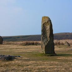
Mitchell's Fold, Bronze Age stone circle in Chirbury with Brompton, England

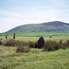
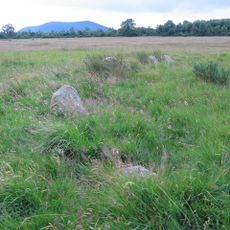
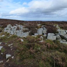
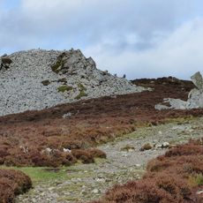
Mitchell's Fold is a Bronze Age stone circle near Chirbury featuring 15 remaining dolerite stones that were originally quarried from nearby Stapeley Hill. The stones form a ring about 30 meters across, displaying the typical layout for ceremonial gathering places of that era.

The site was built during the Bronze Age when communities across Britain constructed stone circles for ritual purposes. Stones were carefully selected from a nearby hill and arranged in this circular formation.

The place is linked to an old tale about an enchanted cow that gave endless milk until a witch's interference caused her to turn into one of the stones.

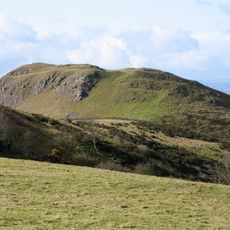
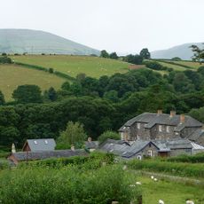
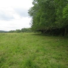
The site sits on Stapeley Common at about 305 meters elevation and is accessible via public footpaths through the Shropshire countryside. Visitors should bring suitable clothing as the location is exposed and weather conditions can change quickly.

In 1995 several stones were removed by farmers using mechanical equipment, but were later returned to their original positions following legal action. This event highlighted the ongoing importance of protecting such archaeological places.

Location: Chirbury with Brompton

Part of: Mitchell's Fold stone circle, standing stone and cairn 280m south west of Mitchell's Fold

Website: https://english-heritage.org.uk/visit/places/mitchells-fold-stone-circle

GPS coordinates: 52.57870,-3.02610

Latest update: December 6, 2025 17:41

Photos
Stone circles: England, Scotland, Ireland, Germany and across Europe & USA

Stone circles stand among humanity's earliest architectural accomplishments, constructed by prehistoric communities across Europe and beyond over thousands of years. These circular arrangements of standing stones served multiple purposes, functioning as astronomical observatories where ancient...

Around this place
Corndon Hill
United Kingdom

Corndon Hill

1.5 km
Hoarstones
United Kingdom

Hoarstones

2.4 km
Roundton Hill
United Kingdom

Roundton Hill

3.6 km
St Nicholas' Church, Church Stoke
United Kingdom

St Nicholas' Church, Church Stoke

5.6 km
The Lack
United Kingdom

The Lack

6.1 km
Church of Holy Trinity
United Kingdom

Church of Holy Trinity

4.7 km
Church of St Michael
United Kingdom

Church of St Michael

4.4 km
Church of Holy Trinity
United Kingdom

Church of Holy Trinity

1.3 km
Church of St Mark
United Kingdom

Church of St Mark

4.6 km
Church of All Saints
United Kingdom

Church of All Saints

3.1 km
St Etheldreda
United Kingdom

St Etheldreda

3.9 km
Gunley Hall
United Kingdom

Gunley Hall

5.2 km
The Cock Inn
United Kingdom

The Cock Inn

6.2 km
Chirbury War Memorial
United Kingdom

Chirbury War Memorial

4.4 km
Brynafon
United Kingdom

Brynafon

5.5 km
Milestone At Ngr So 3246 9695
United Kingdom

Milestone At Ngr So 3246 9695

2.3 km
Milestone At Ngr Sj 3396 0102
United Kingdom

Milestone At Ngr Sj 3396 0102

4.3 km
Group Of 10 Chest Tombs Approximately 3.5 To 10 Metres South Of Chancel Of Church Of St Michael
United Kingdom

Group Of 10 Chest Tombs Approximately 3.5 To 10 Metres South Of Chancel Of Church Of St Michael

4.4 km
Remains Of Engine House Approximately 50 Metres North East Of Gritt Farmhouse
United Kingdom

Remains Of Engine House Approximately 50 Metres North East Of Gritt Farmhouse

2.2 km
Remains Of Engine House At Ngr So 3193 9797
United Kingdom

Remains Of Engine House At Ngr So 3193 9797

1.4 km
Milestone At Ngr So 3214 9845
United Kingdom

Milestone At Ngr So 3214 9845

1.6 km
Milestone At Ngr So 2410 9777
United Kingdom

Milestone At Ngr So 2410 9777

6.5 km
Mitchell's Fold stone circle, standing stone and cairn 280m south west of Mitchell's Fold
United Kingdom

Mitchell's Fold stone circle, standing stone and cairn 280m south west of Mitchell's Fold

140 m
Stockton Wood
United Kingdom

Stockton Wood

5.5 km
Tor cairn on Stiperstones, 130m SSE of Manstone Rock.
United Kingdom

Tor cairn on Stiperstones, 130m SSE of Manstone Rock.

6.2 km
Round cairn on Stiperstones, 350m SSW of the Devil's Chair
United Kingdom

Round cairn on Stiperstones, 350m SSW of the Devil's Chair

6.2 km
Round cairn on Stiperstones, 150m south of Manstone Rock.
United Kingdom

Round cairn on Stiperstones, 150m south of Manstone Rock.

6.2 km
Milestone, St Michaels Church, Chirbury
United Kingdom

Milestone, St Michaels Church, Chirbury

4.5 km
Show the full map
Reviews

Visited this place? Tap the stars to rate it and share your experience / photos with the community! Try now! You can cancel it anytime.

« Mitchell's Fold - Bronze Age stone circle in Chirbury with Brompton, England » is provided by Around Us (aroundus.com). Images and texts are derived from Wikimedia project under a Creative Commons license. You are allowed to copy, distribute, and modify copies of this page, under the conditions set by the license, as long as this note is clearly visible.

Discover hidden gems everywhere you go!

From secret cafés to breathtaking viewpoints, skip the crowded tourist spots and find places that match your style. Our app makes it easy with voice search, smart filtering, route optimization, and insider tips from travelers worldwide. Download now for the complete mobile experience.

Around Us App Screenshot

A unique approach to discovering new places

Le Figaro

All the places worth exploring

France Info

A tailor-made excursion in just a few clicks

20 Minutes