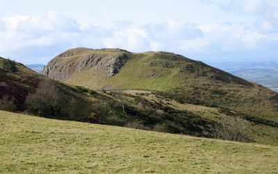
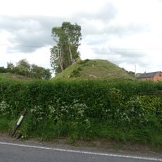
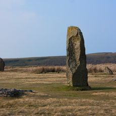
Roundton Hill, Summit and contour fort in Powys, Wales
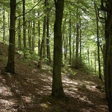
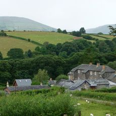
Roundton Hill is a summit and contour fort in Powys, Wales, rising to about 371 meters with volcanic origins. The slopes feature acid grassland, exposed rock outcrops, and support numerous plant species that thrive on this special terrain.
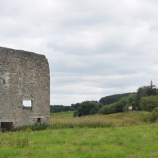
An Iron Age fortified settlement once stood at this summit. Later, during Wales industrial expansion, the site became important for extracting lead and barites.
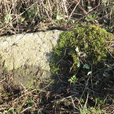
The protected national nature reserve maintains geological evidence of ancient volcanic activity while providing crucial spaces for bat colonies in former mine shafts.
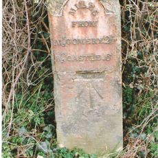
Access is through a dedicated car park located beyond a ford crossing. The terrain can be challenging during wet weather, so sturdy footwear and reasonable fitness help with the walk.
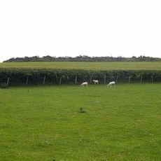
The nutrient-poor soil supports rare spring plants that grow nowhere else in the region. Among these are two nationally important moss species and specialized lichen types found on this particular site.
Location: Powys
GPS coordinates: 52.54771,-3.04256
Latest update: December 14, 2025 17:04
Mitchell's Fold
3.6 km
Corndon Hill
2.3 km
St Nicholas' Church, Church Stoke
2.5 km
The Lack
3.1 km
Linley Hall
5.6 km
Pentre Wood
3.7 km
Church of St Michael
4.8 km
Church of Holy Trinity
4.4 km
St Etheldreda
2 km
Mellington Hall
4.6 km
Chirbury War Memorial
4.8 km
Brynafon
2.4 km
Milestone at NGR SO 2463 9319
5.2 km
Caer Din
5.6 km
Milestone At Ngr So 3246 9695
3.6 km
Motte and bailey castle and line of Offa's Dyke adjacent to Brompton Mill
4.6 km
Milestone Approximately 220 Metres To South Of Heblands Cottage
5.5 km
Stables At Linley Hall
5.6 km
Milestone At Ngr So 2448 9376
5 km
Remains Of Engine House At Ngr So 3193 9797
4 km
Milestone Approximately 390 Metres To East Of Upper Broughton Farmhouse
4.4 km
Remains Of Engine House Approximately 50 Metres North East Of Gritt Farmhouse
4.5 km
Mellington Gatehouse
4.7 km
Milestone Approximately 260 Metres To South Of Heblands Cottages (That Part In Bishop's Castle Cp)
5.5 km
Group Of 10 Chest Tombs Approximately 3.5 To 10 Metres South Of Chancel Of Church Of St Michael
4.8 km
Mitchell's Fold stone circle, standing stone and cairn 280m south west of Mitchell's Fold
3.6 km
Milestone At Ngr So 3214 9845
4.5 km
Milestone, St Michaels Church, Chirbury
4.9 kmVisited this place? Tap the stars to rate it and share your experience / photos with the community! Try now! You can cancel it anytime.
Discover hidden gems everywhere you go!
From secret cafés to breathtaking viewpoints, skip the crowded tourist spots and find places that match your style. Our app makes it easy with voice search, smart filtering, route optimization, and insider tips from travelers worldwide. Download now for the complete mobile experience.
A unique approach to discovering new places❞
— Le Figaro
All the places worth exploring❞
— France Info
A tailor-made excursion in just a few clicks❞
— 20 Minutes