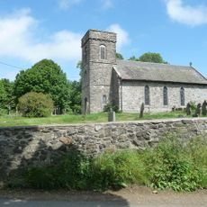
Corndon Hill, Hill summit and nature reserve in Powys, United Kingdom
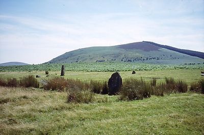
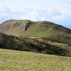
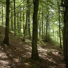
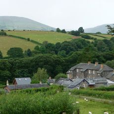
Corndon Hill is a 513-meter summit on the England-Wales border that stands out distinctly from the surrounding landscape. It contains prehistoric stone circles and Bronze Age remains, functioning today as a protected natural area with multiple access routes for walkers.
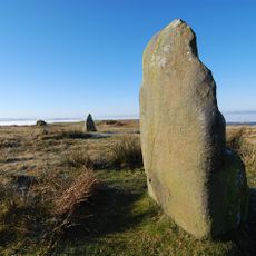
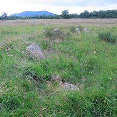
Bronze Age burials between 2500 and 700 BC marked the earliest human activity on the summit, when the site served ceremonial purposes. Stone circles were constructed in subsequent periods, preserving evidence of these ancient communities into the present day.
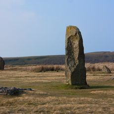
Mitchell's Fold stone circle at the base has roots in local folklore about a fairy woman who milked cows at the site centuries ago. The story remains woven into how people in the region understand and speak about this place.
The easiest access starts from Mitchell's Fold car park, with well-marked trails leading to the summit that see regular foot traffic. Moderate fitness is needed for the walk, and visitors should come prepared for changeable weather conditions, especially wind exposure at higher elevations.
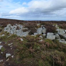
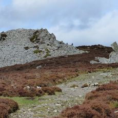
The hill contains picrite, a rare volcanic rock that prehistoric people quarried to make tools, especially shaft-hole implements. These distinctive stone artifacts were later classified by archaeologists and represent important evidence of early toolmaking in western Britain.
Location: Powys
Elevation above the sea: 513 m
GPS coordinates: 52.56548,-3.02528
Latest update: December 12, 2025 09:04
Mitchell's Fold
1.5 km
Hoarstones
3.5 km
Roundton Hill
2.3 km
St Nicholas' Church, Church Stoke
4.5 km
The Lack
5.1 km
Linley Hall
5.7 km
Church of Holy Trinity
5.8 km
Pentre Wood
6 km
Church of St Michael
4.7 km
Church of St Mark
6 km
Church of Holy Trinity
2.6 km
Church of All Saints
3.7 km
St Etheldreda
2.4 km
Gunley Hall
6.1 km
Brynafon
4.5 km
Chirbury War Memorial
4.7 km
Milestone At Ngr Sj 3396 0102
5.3 km
Milestone At Ngr So 3246 9695
1.8 km
Stables At Linley Hall
5.7 km
Milestone At Ngr So 3214 9845
2.2 km
Group Of 10 Chest Tombs Approximately 3.5 To 10 Metres South Of Chancel Of Church Of St Michael
4.7 km
Remains Of Engine House At Ngr So 3193 9797
1.7 km
Remains Of Engine House Approximately 50 Metres North East Of Gritt Farmhouse
2.4 km
Milestone Approximately 390 Metres To East Of Upper Broughton Farmhouse
6.2 km
Mitchell's Fold stone circle, standing stone and cairn 280m south west of Mitchell's Fold
1.5 km
Tor cairn on Stiperstones, 130m SSE of Manstone Rock.
6.4 km
Round cairn on Stiperstones, 150m south of Manstone Rock.
6.3 km
Milestone, St Michaels Church, Chirbury
4.8 kmVisited this place? Tap the stars to rate it and share your experience / photos with the community! Try now! You can cancel it anytime.
Discover hidden gems everywhere you go!
From secret cafés to breathtaking viewpoints, skip the crowded tourist spots and find places that match your style. Our app makes it easy with voice search, smart filtering, route optimization, and insider tips from travelers worldwide. Download now for the complete mobile experience.
A unique approach to discovering new places❞
— Le Figaro
All the places worth exploring❞
— France Info
A tailor-made excursion in just a few clicks❞
— 20 Minutes