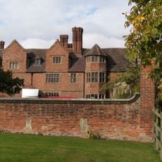
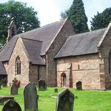
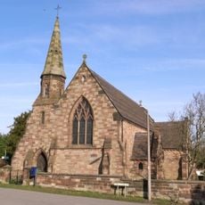
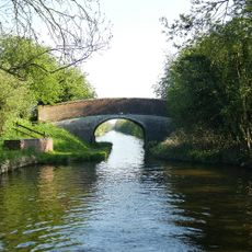
Lapley Priory, Medieval priory ruins in Lapley, England
Lapley Priory is a medieval priory in ruins near the Church of All Saints, with architectural elements from its religious past in the English countryside. The remains are built into an older house structure that was later constructed on the site.
The priory was founded in 1061 by Ælfgar, Lord of Mercia and Chester, and served as a satellite house of Rheims Abbey. It operated for more than 350 years before being shut down in 1415 on the orders of Henry V.
The site shows remains built into an old house structure, revealing how medieval monks shaped the landscape and left their mark on daily life. Visitors can see how religious communities adapted their spaces to suit both spiritual and practical needs.
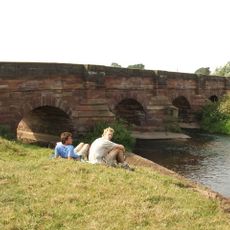
Visitors can see the priory ruins while exploring the Church of All Saints, which is open regularly for religious services and tours. The site is easy to reach because it is located near the village and offers no entrance barriers to observe the remains.
The priory grounds played a strategic military role during the English Civil Wars when the Priory House served as a fortification. The structure was dismantled in 1645 after the royalist defeat to prevent further conflict over the location.
Location: Lapley, Stretton and Wheaton Aston
Inception: 11 century
GPS coordinates: 52.71400,-2.19000
Latest update: December 12, 2025 14:26
Black Ladies Priory
4.4 km
Stretton Hall, Staffordshire
1.9 km
Belvide Reservoir
3.1 km
Speedwell Castle
4.3 km
Stretton Aqueduct
2.2 km
Mottey Meadows
3 km
Penkridge Viaduct
5 km
St John's Church, Stretton
1.9 km
Church of St Mary and St Chad
4.4 km
Church of St Michael and All Angels
5 km
Church of All Saints
24 m
Church of St Mary and All Saints
5.2 km
Church of St John
4.8 km
Church of St Mary
2.1 km
Shropshire Union Canal Wheaton Aston Bridge Number 18
1.4 km
The Railway Inn
5.1 km
Shropshire Union Canal Number 13 (School Bridge)
4.4 km
Dean House
4.5 km
The White Hart
5.2 km
Shropshire Union Canal Ryehill Cutting Bridge (Number 23) At Sj 830 185
3.8 km
Cuttlestone Bridge
4.3 km
Shropshire Union Canal Milepost At Sj 874 104
2.5 km
Railway Bridge Approximately 20 Yards West Of Church Farmhouse
4.9 km
Westgate, Forecourt Wall And Gate Piers
4.5 km
Speedwell Castle
4.3 km
Milepost Shropshire Union Canal 6.5 Miles To South Of Norbury Junction
2.8 km
Shropshire Union Canal Sushions Bridge (Number 21) At Sj 847 147
3.1 km
Milepost Shropshire Union Canal 5.5 Miles To South Of Norbury Junction
4.1 kmVisited this place? Tap the stars to rate it and share your experience / photos with the community! Try now! You can cancel it anytime.
Discover hidden gems everywhere you go!
From secret cafés to breathtaking viewpoints, skip the crowded tourist spots and find places that match your style. Our app makes it easy with voice search, smart filtering, route optimization, and insider tips from travelers worldwide. Download now for the complete mobile experience.
A unique approach to discovering new places❞
— Le Figaro
All the places worth exploring❞
— France Info
A tailor-made excursion in just a few clicks❞
— 20 Minutes