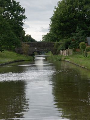
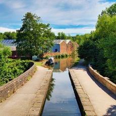
Macclesfield Canal, Navigable waterway in Cheshire, England
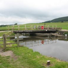
The Macclesfield Canal is a navigable waterway in Cheshire that extends for about 26 kilometers and connects various communities across the region. The route includes 13 locks that allow boats to manage changes in water level.
The waterway was developed in the 1820s and opened to traffic in 1831, marking an important step for moving goods throughout the region. Its construction reflected modern engineering practices of the era and improved connections between industrial centers.
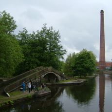
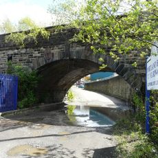
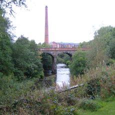
The waterway runs through areas where mills and quarries once operated, shaping the local landscape and economy. These industrial remnants remain visible today, reflecting how water transport connected communities to their livelihoods.
Boaters need to bring a special key for the lock mechanisms and can obtain supplies at several villages along the route. Plan to spend extra time operating the locks, especially if you are unfamiliar with how they work.
The waterway received the first Green Flag award ever given to a canal in Britain in 2015, honoring its upkeep and management. This recognition shows how well the route is maintained today and the commitment local communities have made to preserve it.
GPS coordinates: 53.48330,-2.10000
Latest update: December 10, 2025 15:59
St Michael and All Angels' Church, Ashton-under-Lyne
840 m
St Peter's Church, Ashton-under-Lyne
392 m
Cavendish Mill, Ashton-under-Lyne
190 m
Tameside Hippodrome
534 m
Ashton Under Lyne Town Hall
841 m
Dukinfield Town Hall
787 m
Outer Pennine Ring
79 m
Tudor Mill, Ashton-under-Lyne
80 m
Albion Congregational Church
992 m
Junction Mills, Ashton-under-Lyne
188 m
Hugh Mason Memorial Statue
252 m
Holy Trinity Church
687 m
Church of St Mark
465 m
The Methodist Church
657 m
Dukinfield Old Chapel
1.1 km
Park Parade Railway Viaduct, Eastern Crossing of the River Tame
282 m
Metro Cinema
564 m
Post Office
699 m
Tameside Central Library
463 m
Tame Valley War Memorial
1.1 km
Park Parade Railway Viaduct, Western Crossing of River Tame
279 m
Dukinfield War Memorial
1 km
Aqueduct over the River Tame
125 m
Ashton Under Lyne War Memorial
1 km
Cocking a snook
827 m
Former Municipal Baths
209 m
Market Hall
825 m
3 Chest Tombs To South Of Dukinfield Old Chapel
1.1 kmVisited this place? Tap the stars to rate it and share your experience / photos with the community! Try now! You can cancel it anytime.
Discover hidden gems everywhere you go!
From secret cafés to breathtaking viewpoints, skip the crowded tourist spots and find places that match your style. Our app makes it easy with voice search, smart filtering, route optimization, and insider tips from travelers worldwide. Download now for the complete mobile experience.
A unique approach to discovering new places❞
— Le Figaro
All the places worth exploring❞
— France Info
A tailor-made excursion in just a few clicks❞
— 20 Minutes