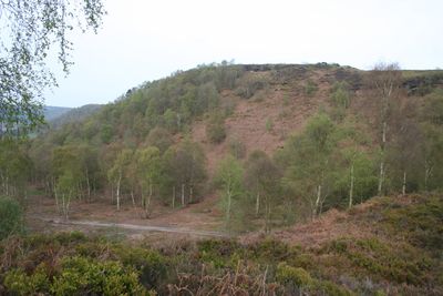
Maiden Castle, Iron Age fort in Bickerton, England
Maiden Castle is an Iron Age fort built on a sandstone ridge in Cheshire, sitting at 212 meters elevation. The structure consists of two parallel defensive banks that exploit the natural steep slopes of the hilltop.
The fort was built during the Iron Age as a hilltop settlement and defensive stronghold for local communities. Excavations in the 1930s revealed pottery and construction details that showed how long the site remained in use.
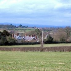
The name comes from a local legend about a young woman connected to this hilltop settlement. Visitors walking around the earthworks today can sense how Iron Age communities chose and shaped this dramatic location.
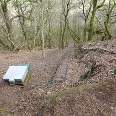
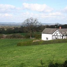
The site is best visited on foot using marked walking trails from nearby parking areas and following the Sandstone Trail. The path crosses open countryside, so visitors should check weather conditions before heading out.
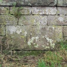
The two defensive banks were built using different construction methods that changed over time. The inner rampart uses dry stone walling reinforced with timber, while the outer bank developed from a timber palisade that was later strengthened with stone.
Location: Cheshire West and Chester
Location: Bickerton
GPS coordinates: 53.07080,-2.75110
Latest update: December 11, 2025 18:10
Bolesworth Castle
3.1 km
Broxton Old Hall
1.1 km
Bulkeley Hill Narrow Gauge Railway
3.8 km
Bulkeley Hall
2.7 km
Lower Carden Hall
3.8 km
All Saints Church, Harthill
2.4 km
Holy Trinity Church, Bickerton
1.4 km
Higher Hall
2.6 km
Bulkeley Methodist Church
3.8 km
Scotch Farm
3.9 km
Barbour Mausoleum in All Saints Churchyard
2.4 km
Halfway House Milestone
2.5 km
Lodge to Broxton Old Hall
1 km
Sandstone chimney to former Copper Mine
2.4 km
Bickerton War Memorial
1.4 km
Holford Charity, Farmhouse
3.8 km
Clutton Lodge (East Lodge)
3.9 km
Boundary Stone
3.9 km
School and schoolmaster's house
2.4 km
Chowley Lodge
3.7 km
Carden Lodge and wing walls
3.7 km
Fountain in front of the School
2.4 km
Lowerhill Farmhouse
3.6 km
Milepost, 150m W of A41 intersection
2.3 km
Milepost, 1/2mile N of Hampton Heath roundabout; 100yds N of Hampton sign
2.9 km
Milepost, opp. Bickerton Church, on cross roads
1.4 km
Milepost, opp. Clutton School
3.6 km
Milepost, S of Duckington Grange, between roads to Duckington
1.7 kmVisited this place? Tap the stars to rate it and share your experience / photos with the community! Try now! You can cancel it anytime.
Discover hidden gems everywhere you go!
From secret cafés to breathtaking viewpoints, skip the crowded tourist spots and find places that match your style. Our app makes it easy with voice search, smart filtering, route optimization, and insider tips from travelers worldwide. Download now for the complete mobile experience.
A unique approach to discovering new places❞
— Le Figaro
All the places worth exploring❞
— France Info
A tailor-made excursion in just a few clicks❞
— 20 Minutes