Norton Camp, Iron Age hillfort in Norton Fitzwarren, England
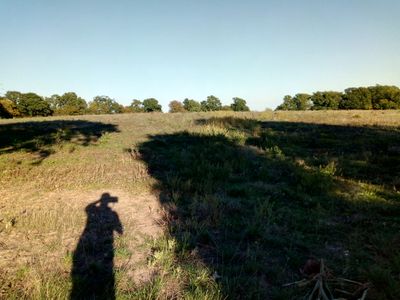
Norton Camp is an Iron Age hillfort located near Norton Fitzwarren in Somerset, occupying a large elevated site with multiple defensive boundaries. The fort contains three distinct entrances connected by ancient pathways that cut through the surrounding earthworks.
The site was first inhabited during the middle Bronze Age before being developed as a fortification in the late Iron Age. Archaeological digs conducted in the late 1960s uncovered artifacts from both periods, revealing the extended occupation and use of this location over many centuries.
The fort's location between two tribal territories indicates its function as a meeting point for different communities during the Late Iron Age period.
Access to the site is available via designated walking trails that wind through the fort. Wear appropriate footwear as the hillside terrain can be muddy and uneven, particularly after rainfall.
The fort is marked by three ancient sunken pathways carved deeply into the hillside, creating distinctive corridors that developed through centuries of repeated use. These hollow ways offer a striking example of how constant foot traffic shaped the landscape over time.
Location: Norton Fitzwarren
GPS coordinates: 51.03010,-3.14750
Latest update: December 14, 2025 11:22
Taunton Castle
2.9 km
Castle Hotel
3.5 km
Museum of Somerset
3.4 km
County Hall
3.4 km
Somerset Military Museum
3.4 km
The Brewhouse Theatre & Arts Centre
3.4 km
Shire Hall
3.4 km
Church of St John the Evangelist
3.3 km
Church of the Holy Cross
3.3 km
Church of All Saints, Norton Fitzwarren
246 m
St Andrew's Church
3 km
Church of St Peter and St Paul, Bishop's Hull
1.7 km
Former Great Western Hotel
3.2 km
Montys Court
1.8 km
Gaumont Palace
3.4 km
Meryan House Hotel
1.7 km
Church of St John
1.6 km
Church of St Luke Chapel at Tone Vale Hospital
3 km
Tone Bridge
3.4 km
Odeon Taunton
2.8 km
Harnham Farmhouse
2.5 km
Manor House
1.7 km
Timber Frame Of Two Bays Of Almshouses In Grounds Of The Castle
3.4 km
The Castle (the Inhabited Parts Only)
3.4 km
16-20, Park Street
3.2 km
115 and 117 Galmington Road and 2 Galmington Lane
2.9 km
Milestone, Staplegrove, by Northway House, Kingston Road
2.9 km
Milestone, Staplegrove, S of entrance to King's Hall School, Kingston Road
3 kmVisited this place? Tap the stars to rate it and share your experience / photos with the community! Try now! You can cancel it anytime.
Discover hidden gems everywhere you go!
From secret cafés to breathtaking viewpoints, skip the crowded tourist spots and find places that match your style. Our app makes it easy with voice search, smart filtering, route optimization, and insider tips from travelers worldwide. Download now for the complete mobile experience.
A unique approach to discovering new places❞
— Le Figaro
All the places worth exploring❞
— France Info
A tailor-made excursion in just a few clicks❞
— 20 Minutes