Piercebridge Roman Fort, Roman military fort in Piercebridge, England
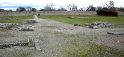
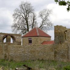
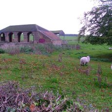
Piercebridge Roman Fort is a scheduled Roman military fort on the south bank of the River Tees in County Durham, England. Stone walls, gateway remains, and the outlines of barracks and administrative buildings are still visible across the site.
The fort was built around 270 AD as a checkpoint on the road connecting York to the northern Roman frontier. After the Romans left, parts of the structure were reused by later settlers over the following centuries.
The village name comes from a medieval bridge built over the River Tees on Roman foundations that are still visible today. Coins and pottery found at the site give a sense of what daily life looked like for soldiers stationed here.
The site is open year-round and free to visit, with parking available in the nearby village. The ground can be uneven and soft in places, so sturdy shoes are a good idea.
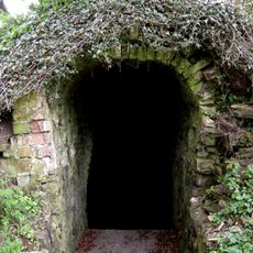
The remains of a Roman bathhouse were later incorporated into a medieval chapel that still stands on the site today. This makes it one of the rare examples in England where a medieval building was constructed so directly on top of a Roman one.
The community of curious travelers
AroundUs brings together thousands of curated places, local tips, and hidden gems, enriched daily by 60,000 contributors worldwide.